
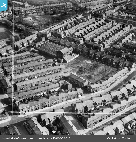
EAW034013 ENGLAND (1950). St Paul's Road Mill, Preston, 1950. This image was marked by Aerofilms Ltd for photo editing.
© Copyright OpenStreetMap contributors and licensed by the OpenStreetMap Foundation. 2026. Cartography is licensed as CC BY-SA.
Nearby Images (13)
EAW034013

EAW034008

EAW034007

EAW034011

EAW034014

EAW034012

EAW034010

EAW034009

EPW061404

EPW061405

EPW061402

EAW033991

EAW033992

Details
| Title | [EAW034013] St Paul's Road Mill, Preston, 1950. This image was marked by Aerofilms Ltd for photo editing. |
| Reference | EAW034013 |
| Date | 14-October-1950 |
| Link | |
| Place name | PRESTON |
| Parish | |
| District | |
| Country | ENGLAND |
| Easting / Northing | 354329, 430025 |
| Longitude / Latitude | -2.6929051111911, 53.764352268907 |
| National Grid Reference | SD543300 |
Pins

Sparky |
Thursday 7th of September 2017 09:26:02 AM | |
|
Sparky |
Thursday 7th of September 2017 09:24:41 AM | |
|
Sparky |
Thursday 7th of September 2017 09:23:50 AM | |
|
Sparky |
Thursday 7th of September 2017 09:23:14 AM | |
|
Sparky |
Thursday 7th of September 2017 09:22:11 AM |