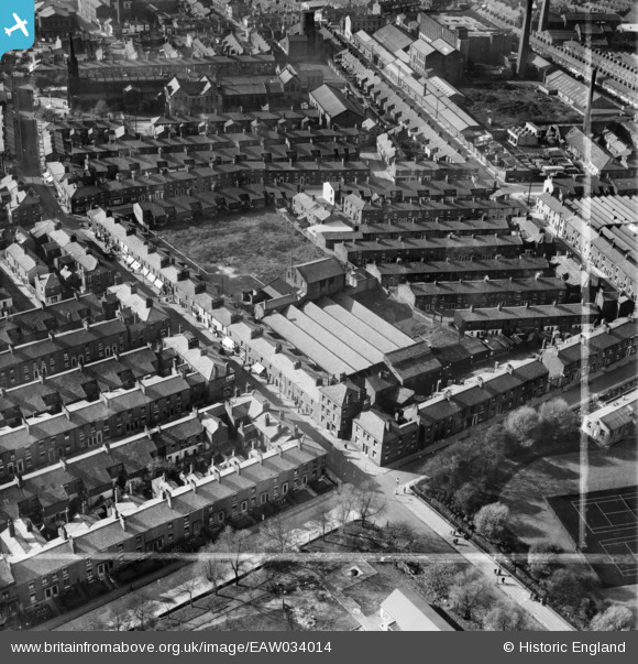
EAW034014 ENGLAND (1950). St Paul's Road Mill, Preston, 1950. This image was marked by Aerofilms Ltd for photo editing.
© Copyright OpenStreetMap contributors and licensed by the OpenStreetMap Foundation. 2026. Cartography is licensed as CC BY-SA.
Nearby Images (11)
Details
| Title | [EAW034014] St Paul's Road Mill, Preston, 1950. This image was marked by Aerofilms Ltd for photo editing. |
| Reference | EAW034014 |
| Date | 14-October-1950 |
| Link | |
| Place name | PRESTON |
| Parish | |
| District | |
| Country | ENGLAND |
| Easting / Northing | 354364, 430015 |
| Longitude / Latitude | -2.6923726668806, 53.764265452525 |
| National Grid Reference | SD544300 |


![[EAW034014] St Paul's Road Mill, Preston, 1950. This image was marked by Aerofilms Ltd for photo editing.](http://britainfromabove.org.uk/sites/all/libraries/aerofilms-images/public/100x100/EAW/034/EAW034014.jpg)
![[EAW034012] St Paul's Road Mill, Preston, 1950. This image was marked by Aerofilms Ltd for photo editing.](http://britainfromabove.org.uk/sites/all/libraries/aerofilms-images/public/100x100/EAW/034/EAW034012.jpg)
![[EAW034010] St Paul's Road Mill, Preston, 1950. This image was marked by Aerofilms Ltd for photo editing.](http://britainfromabove.org.uk/sites/all/libraries/aerofilms-images/public/100x100/EAW/034/EAW034010.jpg)
![[EAW034011] St Paul's Road Mill, Preston, 1950. This image was marked by Aerofilms Ltd for photo editing.](http://britainfromabove.org.uk/sites/all/libraries/aerofilms-images/public/100x100/EAW/034/EAW034011.jpg)
![[EAW034009] St Paul's Road Mill, Preston, 1950. This image was marked by Aerofilms Ltd for photo editing.](http://britainfromabove.org.uk/sites/all/libraries/aerofilms-images/public/100x100/EAW/034/EAW034009.jpg)
![[EAW034007] St Paul's Road Mill, Preston, 1950. This image was marked by Aerofilms Ltd for photo editing.](http://britainfromabove.org.uk/sites/all/libraries/aerofilms-images/public/100x100/EAW/034/EAW034007.jpg)
![[EAW034008] St Paul's Road Mill, Preston, 1950. This image was marked by Aerofilms Ltd for photo editing.](http://britainfromabove.org.uk/sites/all/libraries/aerofilms-images/public/100x100/EAW/034/EAW034008.jpg)
![[EAW034013] St Paul's Road Mill, Preston, 1950. This image was marked by Aerofilms Ltd for photo editing.](http://britainfromabove.org.uk/sites/all/libraries/aerofilms-images/public/100x100/EAW/034/EAW034013.jpg)
![[EPW061404] Hopwood Street Mills, St Paul's Church and surrounding streets, Preston, 1939](http://britainfromabove.org.uk/sites/all/libraries/aerofilms-images/public/100x100/EPW/061/EPW061404.jpg)
![[EPW061405] Hopwood Street Mills, St Paul's Church and surrounding streets, Preston, 1939](http://britainfromabove.org.uk/sites/all/libraries/aerofilms-images/public/100x100/EPW/061/EPW061405.jpg)
![[EPW061402] Hopwood Street Mills and surrounding streets, Preston, 1939](http://britainfromabove.org.uk/sites/all/libraries/aerofilms-images/public/100x100/EPW/061/EPW061402.jpg)
