
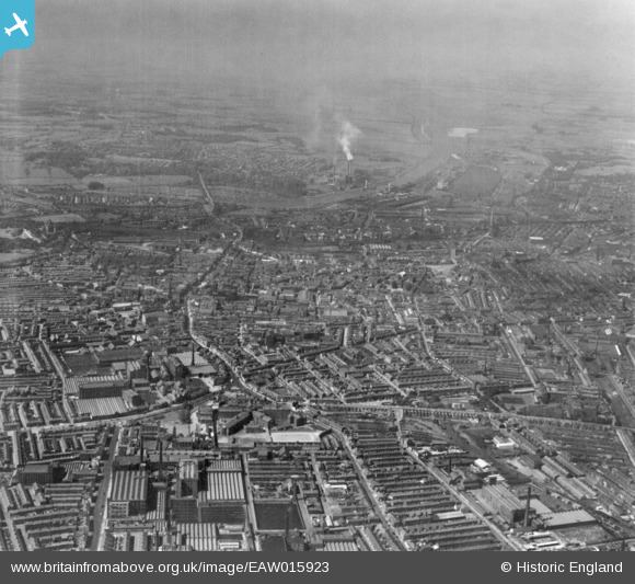
EAW015923 ENGLAND (1948). The city, Preston, from the east, 1948. This image has been produced from a print.
© Copyright OpenStreetMap contributors and licensed by the OpenStreetMap Foundation. 2026. Cartography is licensed as CC BY-SA.
Nearby Images (14)
EAW015923

EAW015927

EAW015901

EAW015928

EAW015929

EAW015903

EAW015906

EAW015895

EAW015907

EPW061402

EAW015896

EPW061405

EAW015899

EAW023381
 and environs, Preston, 1949")
Details
| Title | [EAW015923] The city, Preston, from the east, 1948. This image has been produced from a print. |
| Reference | EAW015923 |
| Date | 20-May-1948 |
| Link | |
| Place name | PRESTON |
| Parish | |
| District | |
| Country | ENGLAND |
| Easting / Northing | 354684, 429755 |
| Longitude / Latitude | -2.68747995547, 53.76195640219 |
| National Grid Reference | SD547298 |
Pins
Be the first to add a comment to this image!