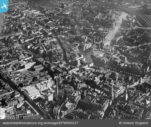
EPW060117 ENGLAND (1938). The city centre, Bristol, 1938

© Copyright OpenStreetMap contributors and licensed by the OpenStreetMap Foundation. 2024. Cartography is licensed as CC BY-SA.

Nearby Images (27)

EPW060117
  0° 0m
EPW034450
  118° 96m
EPW034456
  103° 104m
EPW034451
  149° 107m
EAW050553
  355° 144m
EPW038301
  176° 168m
EPW038302
  177° 169m
EPW038300
  205° 172m
EPW034454
  155° 178m
EPW005420
  310° 190m
EPW034459
  157° 190m
EPW033498
  224° 197m
EPW034460
  166° 197m
EPW038304
  198° 199m
EPW038303
  203° 203m
EPW034453
  158° 205m
EPW034455
  176° 205m
EPW005421
  309° 210m
EPW034458
  163° 214m
EPW034452
  167° 219m
EPW034457
  150° 226m
EPW005426
  298° 242m
EPW005423
  296° 245m
EPW005424
  306° 247m
EPW005425
  304° 249m
EPW005427
  297° 277m
EPW005422
  319° 287m

Details

Title [EPW060117] The city centre, Bristol, 1938
Reference EPW060117
Date 1-November-1938
Link
Place name BRISTOL
Parish
District
Country ENGLAND
Easting / Northing 359153, 173089
Longitude / Latitude -2.5879430676122, 51.454817615079
National Grid Reference ST592731

Pins

Site of Newgate Gaol demolished 1821

Braikenridge
Monday 27th of April 2015 12:43:13 PM
Mary Le Port church. Only the perp. tower 72 feet high to the battlements survives as the body of the church was bombed

Braikenridge
Monday 27th of April 2015 12:42:05 PM
Castle Green School, 1887 which towered over the area. It faced down Castle Green and was burnt out in the blitz

Braikenridge
Monday 27th of April 2015 12:40:03 PM
St Johns arch removed 1911. A postern gate in the inner town wall built sometime in the 11th century.

Braikenridge
Monday 27th of April 2015 12:37:32 PM
The inner castle wall c.1135. The outer wall is represented by the hoarding on Broadweir immediately to the left which rose straight out of the moat (mill pond) the man made arm of the Frome. The moat here along Broadweir was 35-40 feet wide and around 5-7 feet deep. It was scoured to 10 feet deep 1848 and culverted around 1866.

Braikenridge
Monday 27th of April 2015 12:34:41 PM
1750s housing in Philadelphia St that survived the slum clearance of 1930 as they were in commercial use

Braikenridge
Monday 27th of April 2015 12:29:41 PM
Marks and Spencer. a large complex of buildings between Castle St and Castle Green.

Braikenridge
Monday 27th of April 2015 12:27:37 PM
Aerial footbridge connecting Baker and Baker retail store to their Wholesale section and warehousing. All bombed. The footbridge and tottering remains were cleared to basement level soon after, which was on average 12 feet deep.

Braikenridge
Monday 27th of April 2015 12:26:07 PM
Union Street Bridge, single span 24 feet wide over the river Frome built 1771-76. Road deck 31'6" above the river 1776-1809 and 30 feet above the river once Bridewell Weir had been removed 1809. In 1828 Mylne's culvert and the floodgates at Stonebridge lowered the level of the Frome to a trickle in Summer and a few feet in Winter, making the drop around 42 feet (including parapet) There was a land arch either side under the Union St ramp. The river either side was culverted 1866-1871, making Fairfax St to the east, with steps up to Union St, and a blanked off wall to the west, where Fry's factory annex 2A was laid out. This factory was burnt out and the site cleared by 1953, when the blocked up river arch and southern land arch were removed and a new ferro concrete road deck inserted. Fairfax St was also made right through on a new alignment to Nelson St, through the plots of the former chocolate factories.

Braikenridge
Monday 27th of April 2015 12:22:56 PM
The western end of Castle St at its junction with Peter St and Little Peter St (also called Bear Lane after the early 17th century inn the Bear and Rugged Staff) Castle St ran east for 990 feet on a slight downward grade to a crossroads with Old Market, Lower Castle St (also known as Castle Ditch) and Tower Hill. Buildings were originally laid out through the former castle between 1629 and 1700, consisting of half timbered gabled buildings with 2 floors on average plot widths of 16-21 feet.

Braikenridge
Monday 27th of April 2015 12:13:29 PM
Dolphin St c1776. Bristol's shortest street; from Peter St/ Mary Le Port St crossroads to Wine St / Narrow Wine St crossroads. Completely blitzed.

Braikenridge
Monday 27th of April 2015 12:07:54 PM
St. Peter's Church, Bristol, 04/03/2014

Class31
Monday 27th of April 2015 08:43:25 AM
Bristol Tramways and Carriage Company Ltd, Temple Backs electricity generating station built 1899-1901, with 265 feet high chimney

Braikenridge
Monday 27th of April 2015 08:32:41 AM
Fry's Factory no1 chimney 1877, 199 feet high. felled 1961

Braikenridge
Monday 27th of April 2015 08:30:34 AM
Broadmead Baptist Chapel, Lower Union St.

Braikenridge
Monday 27th of April 2015 08:20:17 AM
Boots the Chemist, flagship store facing Castle St and Tower St

Braikenridge
Monday 27th of April 2015 08:18:42 AM
British Home Stores, with modern art deco facades facing Castle St and Tower Hill, with a great concrete raft over the castle moat below.

Braikenridge
Monday 27th of April 2015 08:17:45 AM
The Greyhound and Old Post office coaching inns, Broadmead

Braikenridge
Monday 27th of April 2015 08:16:09 AM
St Peters Hospital. Norton's House 1402, rebuilt and extended by Robert Aldworth 1612/13. 130 feet fronting the churchyard, rear facing the river wall

Braikenridge
Monday 27th of April 2015 08:10:42 AM
Llewellyn and James Brass works, Castle Green and Cock and Bottle Lane

Braikenridge
Monday 27th of April 2015 08:04:50 AM
Freemasons inscribed Pediment of 15 Bridge St, c1775. the centre of the great 500 foot x 34 foot south terrace. The upper rooms contained a Freemason's hall.

Braikenridge
Monday 27th of April 2015 08:03:50 AM
aerial footbridge between 1937 Co-Op Education Centre towering over Broadweir and the main offices and dept store in Castle Green and St. whole complex Pulled down 1963

Braikenridge
Monday 27th of April 2015 08:01:36 AM
The rebuilt Rising Sun, corner of Lower Castle St with Ellbroad St, 1905-1956

Braikenridge
Monday 27th of April 2015 07:57:21 AM
St Peters School, built on the site of 1 and 2 Castle Green,the site of Newgate and the original drawbridge into the outer Castle Ward Pulled down around 1959/60

Braikenridge
Monday 27th of April 2015 07:56:07 AM
The massive Regent Cinema, Castle St, opened 1928. Ruins cleared 1963.

Braikenridge
Monday 27th of April 2015 07:53:38 AM
The Bank Hotel, Bridge St.

Braikenridge
Monday 27th of April 2015 07:52:34 AM
The Dutch House, 389 days before it was burnt out and had to be pulled down.

Braikenridge
Monday 27th of April 2015 07:51:32 AM

MildBunch
Wednesday 18th of February 2015 02:22:07 PM
The Odeon, Union Street which opened in 1938, photographed 4/3/2014

Class31
Tuesday 4th of March 2014 07:48:54 PM
Christ Church from Corn Street looking east. 06/08/13

Class31
Wednesday 7th of August 2013 12:43:13 PM
Bristol Bridge

Class31
Wednesday 7th of August 2013 12:41:10 PM
Old Market Street

Class31
Friday 21st of June 2013 08:08:09 AM