
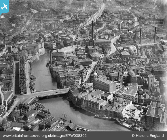
EPW038302 ENGLAND (1932). Industry around the Bristol Bridge, Bristol, 1932
© Copyright OpenStreetMap contributors and licensed by the OpenStreetMap Foundation. 2026. Cartography is licensed as CC BY-SA.
Nearby Images (26)
EPW038302

EPW038301

EPW034455

EPW034460
 and the Tramway Generating Station, Bristol, 1930")
EPW034452

EPW034458

EPW034459
 and the Tramway Generating Station, Bristol, 1930")
EPW034454
 and the Tramway Generating Station, Bristol, 1930")
EPW038304

EPW034453

EPW038300

EPW038303

EPW034451

EPW034457

EAW032256

EAW032257

EAW032259

EPW034450

EPW033498

EAW032254

EAW032258

EPW060117

EPW034456

EAW032255

EAW032260

EAW032261

Details
| Title | [EPW038302] Industry around the Bristol Bridge, Bristol, 1932 |
| Reference | EPW038302 |
| Date | June-1932 |
| Link | |
| Place name | BRISTOL |
| Parish | |
| District | |
| Country | ENGLAND |
| Easting / Northing | 359159, 172920 |
| Longitude / Latitude | -2.5878371909261, 51.453298382515 |
| National Grid Reference | ST592729 |
Pins

adfbristol |
Monday 15th of July 2013 10:41:56 PM | |
|
adfbristol |
Monday 15th of July 2013 10:41:17 PM | |
|
adfbristol |
Monday 15th of July 2013 10:39:50 PM | |
|
adfbristol |
Monday 15th of July 2013 10:38:55 PM | |
|
adfbristol |
Monday 15th of July 2013 10:38:11 PM | |

Class31 |
Monday 10th of June 2013 08:59:23 PM | |
|
Braikenridge |
Sunday 6th of January 2013 11:35:46 AM | |
|
Braikenridge |
Sunday 6th of January 2013 11:33:27 AM |
