
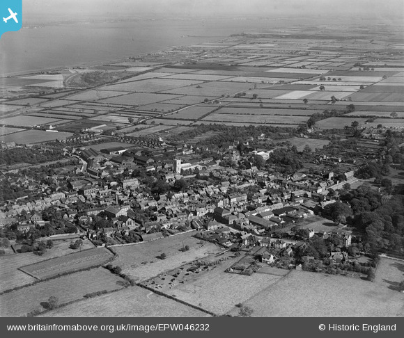
EPW046232 ENGLAND (1934). The town and surrounding countryside, Barton-upon-Humber, from the west, 1934
© Copyright OpenStreetMap contributors and licensed by the OpenStreetMap Foundation. 2026. Cartography is licensed as CC BY-SA.
Nearby Images (20)
EPW046232

EPW046229

EAW046050

EAW046049

EPW046225

EPW046226

EAW046055

EPW046222

EAW046052

EPW046227

EAW046054

EAW046053

EPW012679

EPW046234

EAW046159

EAW046160

EPW046230

EPW046228

EAW046051

EAW031244

Details
| Title | [EPW046232] The town and surrounding countryside, Barton-upon-Humber, from the west, 1934 |
| Reference | EPW046232 |
| Date | September-1934 |
| Link | |
| Place name | BARTON-UPON-HUMBER |
| Parish | BARTON-UPON-HUMBER |
| District | |
| Country | ENGLAND |
| Easting / Northing | 503066, 421829 |
| Longitude / Latitude | -0.43930427263125, 53.682511578435 |
| National Grid Reference | TA031218 |
Pins

DaveH |
Monday 6th of January 2020 05:16:57 PM |