
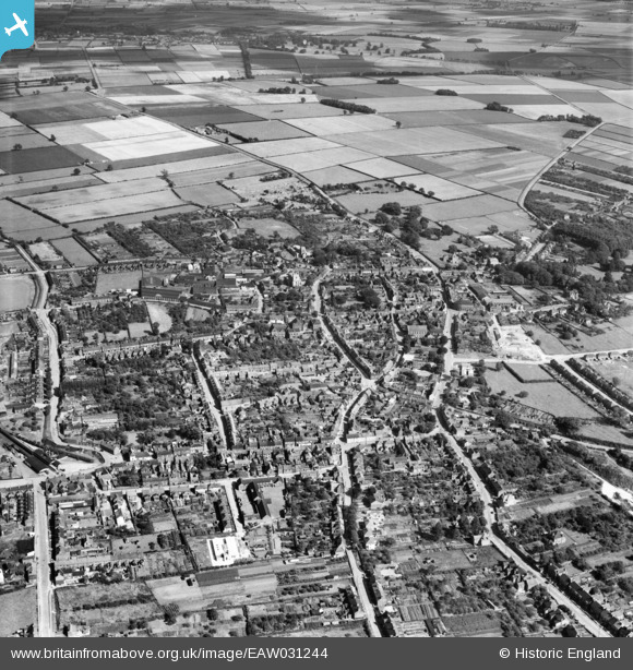
EAW031244 ENGLAND (1950). The town, Barton-Upon-Humber, 1950
© Copyright OpenStreetMap contributors and licensed by the OpenStreetMap Foundation. 2026. Cartography is licensed as CC BY-SA.
Nearby Images (17)
EAW031244

EAW046160

EPW012679

EPW046221

EAW046161

EAW046052

EPW046231

EAW046041
, Barton-Upon-Humber, 1952. This image was marked by Aerofilms Ltd for photo editing.")
EAW046050

EPW012678

EAW046054

EAW046053

EPW012677

EAW046049

EAW046048
, Barton-Upon-Humber, from the north-west, 1952. This image was marked by Aerofilms Ltd for photo editing.")
EPW046232

EAW046162

Details
| Title | [EAW031244] The town, Barton-Upon-Humber, 1950 |
| Reference | EAW031244 |
| Date | 25-July-1950 |
| Link | |
| Place name | BARTON-UPON-HUMBER |
| Parish | BARTON-UPON-HUMBER |
| District | |
| Country | ENGLAND |
| Easting / Northing | 503123, 422074 |
| Longitude / Latitude | -0.43836002884582, 53.684701862653 |
| National Grid Reference | TA031221 |
Pins
Be the first to add a comment to this image!