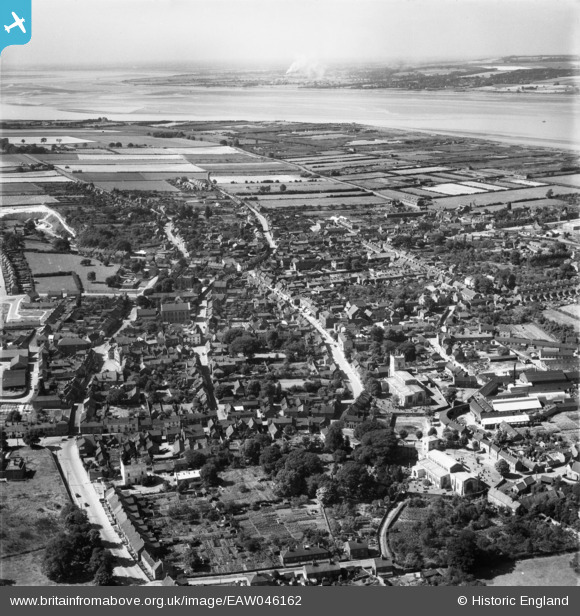
EAW046162 ENGLAND (1952). The town, Barton-Upon-Humber, from the east, 1952
© Copyright OpenStreetMap contributors and licensed by the OpenStreetMap Foundation. 2026. Cartography is licensed as CC BY-SA.
Nearby Images (24)
Details
| Title | [EAW046162] The town, Barton-Upon-Humber, from the east, 1952 |
| Reference | EAW046162 |
| Date | 22-August-1952 |
| Link | |
| Place name | BARTON-UPON-HUMBER |
| Parish | BARTON-UPON-HUMBER |
| District | |
| Country | ENGLAND |
| Easting / Northing | 503368, 421897 |
| Longitude / Latitude | -0.4347103940631, 53.683062952031 |
| National Grid Reference | TA034219 |
Pins

Val |
Monday 12th of December 2016 08:26:42 PM | |

Class31 |
Wednesday 15th of October 2014 03:44:55 PM | |

Class31 |
Wednesday 15th of October 2014 03:42:04 PM | |

Class31 |
Wednesday 15th of October 2014 03:40:43 PM | |

Class31 |
Monday 29th of September 2014 11:04:19 PM | |

Class31 |
Monday 29th of September 2014 11:03:03 PM |
User Comment Contributions

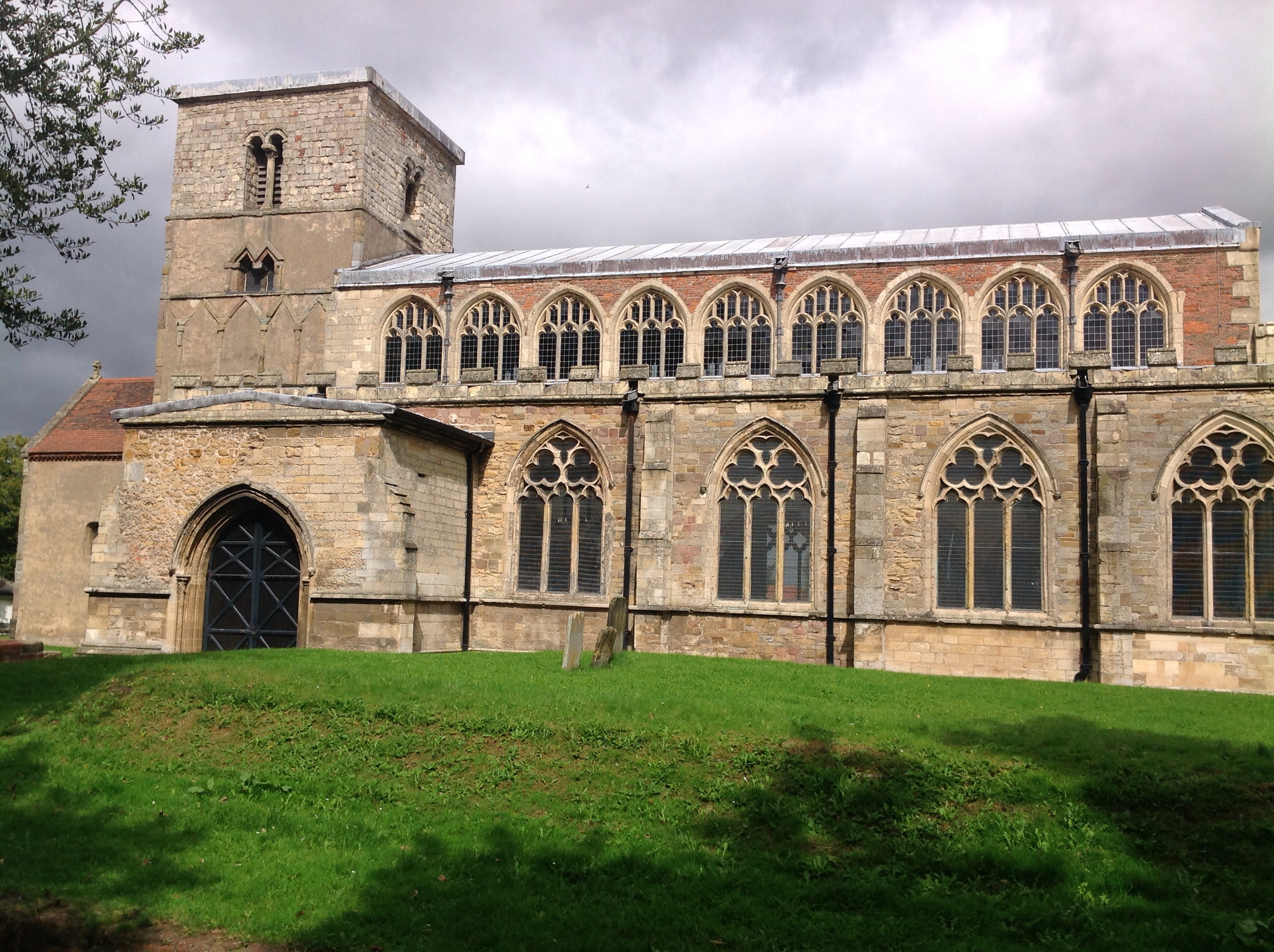
St. Peter's Church, 29/08/2014 |

Class31 |
Friday 29th of August 2014 08:52:44 PM |


![[EAW046162] The town, Barton-Upon-Humber, from the east, 1952](http://britainfromabove.org.uk/sites/all/libraries/aerofilms-images/public/100x100/EAW/046/EAW046162.jpg)
![[EPW012678] St Mary's Church and the Cycle Works, Barton-upon-Humber, 1925](http://britainfromabove.org.uk/sites/all/libraries/aerofilms-images/public/100x100/EPW/012/EPW012678.jpg)
![[EPW046231] The Elswick-Hopper Cycle Co Works, St Mary's Church and the town, Barton-upon-Humber, 1934](http://britainfromabove.org.uk/sites/all/libraries/aerofilms-images/public/100x100/EPW/046/EPW046231.jpg)
![[EPW046233] St Mary's Cycle Works, St Mary's Church and St Peter's Church, Barton-upon-Humber, 1934](http://britainfromabove.org.uk/sites/all/libraries/aerofilms-images/public/100x100/EPW/046/EPW046233.jpg)
![[EAW046159] The town, Barton-Upon-Humber, 1952](http://britainfromabove.org.uk/sites/all/libraries/aerofilms-images/public/100x100/EAW/046/EAW046159.jpg)
![[EAW046053] The Elswick Hopper Cycle Works off Castledykes South and the town centre, Barton-Upon-Humber, 1952. This image was marked by Aerofilms Ltd for photo editing.](http://britainfromabove.org.uk/sites/all/libraries/aerofilms-images/public/100x100/EAW/046/EAW046053.jpg)
![[EAW046054] The Elswick Hopper Cycle Works off Castledykes South and the town centre, Barton-Upon-Humber, 1952. This image was marked by Aerofilms Ltd for photo editing.](http://britainfromabove.org.uk/sites/all/libraries/aerofilms-images/public/100x100/EAW/046/EAW046054.jpg)
![[EPW012680] St Mary's Church and the town, Barton-upon-Humber, from the south-east, 1925](http://britainfromabove.org.uk/sites/all/libraries/aerofilms-images/public/100x100/EPW/012/EPW012680.jpg)
![[EAW046052] The Elswick Hopper Cycle Works off Castledykes South and the town centre, Barton-Upon-Humber, 1952. This image was marked by Aerofilms Ltd for photo editing.](http://britainfromabove.org.uk/sites/all/libraries/aerofilms-images/public/100x100/EAW/046/EAW046052.jpg)
![[EPW046230] The town and the River Humber, Barton-upon-Humber, from the south, 1934](http://britainfromabove.org.uk/sites/all/libraries/aerofilms-images/public/100x100/EPW/046/EPW046230.jpg)
![[EAW046051] The Elswick Hopper Cycle Works off Castledykes South, Barton-Upon-Humber, 1952. This image was marked by Aerofilms Ltd for photo editing.](http://britainfromabove.org.uk/sites/all/libraries/aerofilms-images/public/100x100/EAW/046/EAW046051.jpg)
![[EPW012677] View of the town, St Mary's Church and the Cycle Works, Barton-upon-Humber, 1925](http://britainfromabove.org.uk/sites/all/libraries/aerofilms-images/public/100x100/EPW/012/EPW012677.jpg)
![[EAW046055] The Elswick Hopper Cycle Works off Castledykes South, Barton-Upon-Humber, 1952. This image was marked by Aerofilms Ltd for photo editing.](http://britainfromabove.org.uk/sites/all/libraries/aerofilms-images/public/100x100/EAW/046/EAW046055.jpg)
![[EPW046223] St Mary's Cycle Works, St Mary's Church and St Peter's Church, Barton-upon-Humber, 1934](http://britainfromabove.org.uk/sites/all/libraries/aerofilms-images/public/100x100/EPW/046/EPW046223.jpg)
![[EPW046227] The Elswick-Hopper Cycle Co Works and the town centre, Barton-upon-Humber, 1934](http://britainfromabove.org.uk/sites/all/libraries/aerofilms-images/public/100x100/EPW/046/EPW046227.jpg)
![[EPW046226] The Elswick-Hopper Cycle Co Works and the town centre, Barton-upon-Humber, 1934](http://britainfromabove.org.uk/sites/all/libraries/aerofilms-images/public/100x100/EPW/046/EPW046226.jpg)
![[EAW046049] The Elswick Hopper Cycle Works off Castledykes South and the town centre, Barton-Upon-Humber, 1952. This image was marked by Aerofilms Ltd for photo editing.](http://britainfromabove.org.uk/sites/all/libraries/aerofilms-images/public/100x100/EAW/046/EAW046049.jpg)
![[EPW046225] The Elswick-Hopper Cycle Co Works and the town centre, Barton-upon-Humber, 1934](http://britainfromabove.org.uk/sites/all/libraries/aerofilms-images/public/100x100/EPW/046/EPW046225.jpg)
![[EAW046045] St Mary's Cycle Works (Elswick Hopper), Barton-Upon-Humber, 1952. This image was marked by Aerofilms Ltd for photo editing.](http://britainfromabove.org.uk/sites/all/libraries/aerofilms-images/public/100x100/EAW/046/EAW046045.jpg)
![[EPW046228] The town and the River Humber, Barton-upon-Humber, from the south, 1934](http://britainfromabove.org.uk/sites/all/libraries/aerofilms-images/public/100x100/EPW/046/EPW046228.jpg)
![[EPW046222] The Elswick-Hopper Cycle Co Works, Baysgarth Park and the town centre, Barton-upon-Humber, 1934](http://britainfromabove.org.uk/sites/all/libraries/aerofilms-images/public/100x100/EPW/046/EPW046222.jpg)
![[EAW046044] St Mary's Cycle Works (Elswick Hopper), Barton-Upon-Humber, 1952. This image was marked by Aerofilms Ltd for photo editing.](http://britainfromabove.org.uk/sites/all/libraries/aerofilms-images/public/100x100/EAW/046/EAW046044.jpg)
![[EPW046234] The town and the River Humber, Barton-upon-Humber, from the south-west, 1934](http://britainfromabove.org.uk/sites/all/libraries/aerofilms-images/public/100x100/EPW/046/EPW046234.jpg)
![[EAW031244] The town, Barton-Upon-Humber, 1950](http://britainfromabove.org.uk/sites/all/libraries/aerofilms-images/public/100x100/EAW/031/EAW031244.jpg)