
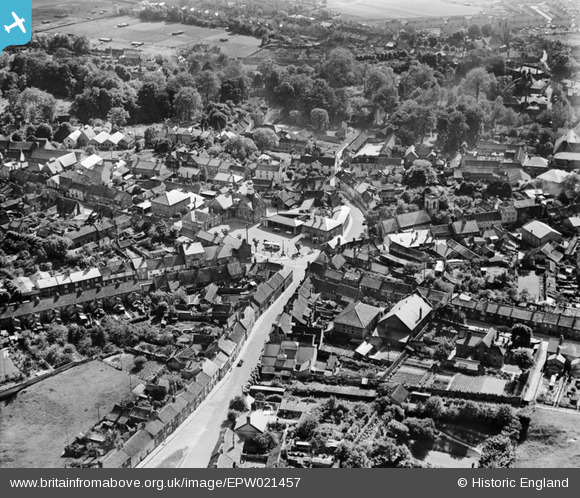
EPW021457 ENGLAND (1928). The Town Centre, Thetford, 1928
© Copyright OpenStreetMap contributors and licensed by the OpenStreetMap Foundation. 2026. Cartography is licensed as CC BY-SA.
Nearby Images (11)
EPW021457

EPW021451

EPW039260

EPW039262

EPW021449

EPW021448

EPW021459

EPW021454

EPW021452

EPW021447

EPW021458

Details
| Title | [EPW021457] The Town Centre, Thetford, 1928 |
| Reference | EPW021457 |
| Date | June-1928 |
| Link | |
| Place name | THETFORD |
| Parish | THETFORD |
| District | |
| Country | ENGLAND |
| Easting / Northing | 587161, 283035 |
| Longitude / Latitude | 0.75220694526787, 52.412868213531 |
| National Grid Reference | TL872830 |
Pins

d.osborne |
Thursday 4th of June 2015 11:30:47 AM | |
|
d.osborne |
Thursday 4th of June 2015 11:28:15 AM | |
|
d.osborne |
Thursday 4th of June 2015 11:27:12 AM | |
|
d.osborne |
Thursday 4th of June 2015 11:25:46 AM | |
|
d.osborne |
Thursday 4th of June 2015 11:24:37 AM | |
|
d.osborne |
Thursday 4th of June 2015 11:21:59 AM | |
|
d.osborne |
Thursday 4th of June 2015 11:20:22 AM | |
|
d.osborne |
Thursday 4th of June 2015 11:19:15 AM | |
|
d.osborne |
Thursday 4th of June 2015 11:17:58 AM | |
|
d.osborne |
Sunday 17th of May 2015 12:54:51 PM |