
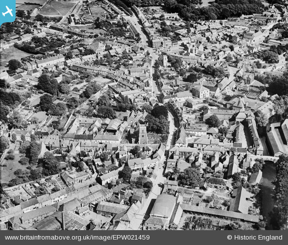
EPW021459 ENGLAND (1928). The Town Centre, Thetford, 1928
© Copyright OpenStreetMap contributors and licensed by the OpenStreetMap Foundation. 2026. Cartography is licensed as CC BY-SA.
Nearby Images (10)
EPW021459

EPW021448

EPW021454

EPW021458

EPW021449

EPW039262

EPW021451

EPW021450

EPW021457

EPW039260

Details
| Title | [EPW021459] The Town Centre, Thetford, 1928 |
| Reference | EPW021459 |
| Date | June-1928 |
| Link | |
| Place name | THETFORD |
| Parish | THETFORD |
| District | |
| Country | ENGLAND |
| Easting / Northing | 586953, 283153 |
| Longitude / Latitude | 0.74921807127581, 52.413999061389 |
| National Grid Reference | TL870832 |
Pins

d.osborne |
Wednesday 8th of July 2015 08:26:34 PM |