
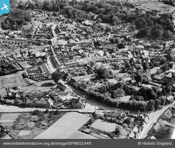
EPW021449 ENGLAND (1928). The Town Centre, Thetford, 1928
© Copyright OpenStreetMap contributors and licensed by the OpenStreetMap Foundation. 2026. Cartography is licensed as CC BY-SA.
Nearby Images (8)
EPW021449

EPW021448

EPW021459

EPW021454

EPW021458

EPW021451

EPW021457

EPW039262

Details
| Title | [EPW021449] The Town Centre, Thetford, 1928 |
| Reference | EPW021449 |
| Date | 13-June-1928 |
| Link | |
| Place name | THETFORD |
| Parish | THETFORD |
| District | |
| Country | ENGLAND |
| Easting / Northing | 587091, 283205 |
| Longitude / Latitude | 0.75127396039558, 52.414418881735 |
| National Grid Reference | TL871832 |
Pins

d.osborne |
Tuesday 2nd of June 2015 02:19:11 AM | |
|
d.osborne |
Monday 11th of May 2015 02:16:44 PM | |
|
d.osborne |
Monday 11th of May 2015 02:13:30 PM | |
|
d.osborne |
Monday 11th of May 2015 02:10:53 PM | |
|
d.osborne |
Monday 11th of May 2015 02:08:30 PM | |
|
d.osborne |
Monday 11th of May 2015 02:06:36 PM | |
|
d.osborne |
Monday 11th of May 2015 02:03:46 PM | |
|
d.osborne |
Monday 11th of May 2015 01:58:28 PM | |
|
d.osborne |
Monday 11th of May 2015 01:55:45 PM | |
|
d.osborne |
Monday 11th of May 2015 01:54:01 PM | |
|
d.osborne |
Monday 11th of May 2015 01:52:08 PM | |
|
d.osborne |
Monday 11th of May 2015 01:50:20 PM | |
|
d.osborne |
Monday 11th of May 2015 01:48:05 PM | |
|
d.osborne |
Friday 1st of May 2015 11:27:21 AM | |
|
d.osborne |
Friday 1st of May 2015 11:20:57 AM | |
|
d.osborne |
Friday 1st of May 2015 11:19:18 AM | |
|
d.osborne |
Friday 1st of May 2015 11:16:09 AM | |
|
d.osborne |
Friday 1st of May 2015 11:12:21 AM | |
|
d.osborne |
Friday 1st of May 2015 11:10:19 AM | |
|
d.osborne |
Friday 1st of May 2015 11:07:23 AM | |
|
MB |
Monday 18th of February 2013 11:00:48 AM | |
|
MB |
Monday 18th of February 2013 10:59:19 AM | |
Site later redeveloped as a health centre with car park |
MB |
Monday 18th of February 2013 11:06:27 AM |
|
MB |
Monday 18th of February 2013 10:58:40 AM | |
|
MB |
Monday 18th of February 2013 10:58:19 AM | |
|
MB |
Monday 18th of February 2013 10:56:10 AM | |
|
MB |
Monday 18th of February 2013 10:54:54 AM | |
|
MB |
Monday 18th of February 2013 10:54:03 AM | |
|
MB |
Monday 18th of February 2013 10:53:29 AM | |
|
MB |
Monday 18th of February 2013 10:52:55 AM | |
|
MB |
Monday 18th of February 2013 10:51:04 AM | |
|
MB |
Monday 18th of February 2013 10:50:20 AM | |
|
MB |
Monday 18th of February 2013 10:39:36 AM | |
|
MB |
Monday 18th of February 2013 10:39:11 AM | |
|
MB |
Monday 18th of February 2013 10:38:10 AM | |
|
MB |
Monday 18th of February 2013 10:36:07 AM | |
|
MB |
Monday 18th of February 2013 10:30:06 AM |