
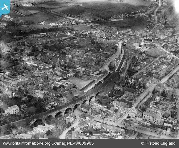
EPW009905 ENGLAND (1924). The town centre, Redruth, 1924
© Copyright OpenStreetMap contributors and licensed by the OpenStreetMap Foundation. 2026. Cartography is licensed as CC BY-SA.
Nearby Images (16)
EPW009905

EPW021734

EPW009902

EAW033647

EPW021731

EAW033649

EPW009904

EPW021730

EPW039787

EPW021733

EPW009903

EPW009904A

EPW039788

EPW021732

EPW039786

EPW009901

Details
| Title | [EPW009905] The town centre, Redruth, 1924 |
| Reference | EPW009905 |
| Date | March-1924 |
| Link | |
| Place name | REDRUTH |
| Parish | REDRUTH |
| District | |
| Country | ENGLAND |
| Easting / Northing | 169940, 41963 |
| Longitude / Latitude | -5.2263020468946, 50.232209733605 |
| National Grid Reference | SW699420 |
Pins

Pentaprism |
Saturday 31st of October 2020 02:30:59 AM |