
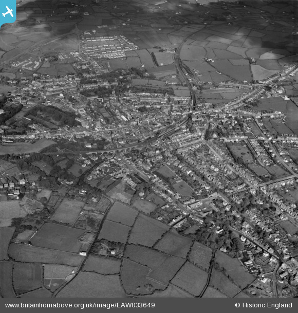
EAW033649 ENGLAND (1950). The town, Redruth, 1950
© Copyright OpenStreetMap contributors and licensed by the OpenStreetMap Foundation. 2026. Cartography is licensed as CC BY-SA.
Nearby Images (12)
EAW033649

EPW009904

EPW039788

EPW021734

EPW009902

EPW009905

EPW009901

EPW039787

EAW033647

EPW021731

EPW009903

EPW021733

Details
| Title | [EAW033649] The town, Redruth, 1950 |
| Reference | EAW033649 |
| Date | 12-October-1950 |
| Link | |
| Place name | REDRUTH |
| Parish | REDRUTH |
| District | |
| Country | ENGLAND |
| Easting / Northing | 169951, 41840 |
| Longitude / Latitude | -5.2260734395633, 50.231109449554 |
| National Grid Reference | SW700418 |
Pins

David Williamson |
Saturday 2nd of January 2016 02:08:32 PM | |
|
David Williamson |
Friday 1st of January 2016 05:18:20 PM | |

Class31 |
Saturday 18th of April 2015 08:03:26 PM | |
|
Class31 |
Saturday 18th of April 2015 08:00:10 PM | |
|
abstejam |
Wednesday 14th of May 2014 09:52:37 PM |

