
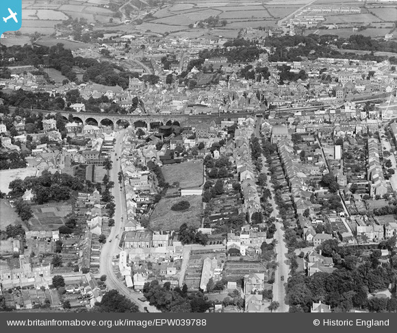
EPW039788 ENGLAND (1932). Falmouth Road, Clinton Road and the Viaduct, Redruth, 1932
© Copyright OpenStreetMap contributors and licensed by the OpenStreetMap Foundation. 2026. Cartography is licensed as CC BY-SA.
Nearby Images (12)
EPW039788

EAW033649

EPW009901

EPW009904

EPW009902

EPW021734

EPW009905

EPW039787

EAW033648

EAW033647

EPW009903

EPW021733

Details
| Title | [EPW039788] Falmouth Road, Clinton Road and the Viaduct, Redruth, 1932 |
| Reference | EPW039788 |
| Date | August-1932 |
| Link | |
| Place name | REDRUTH |
| Parish | REDRUTH |
| District | |
| Country | ENGLAND |
| Easting / Northing | 169997, 41756 |
| Longitude / Latitude | -5.2253785095866, 50.230373007498 |
| National Grid Reference | SW700418 |
Pins

Class31 |
Thursday 15th of December 2016 11:58:12 AM |
