
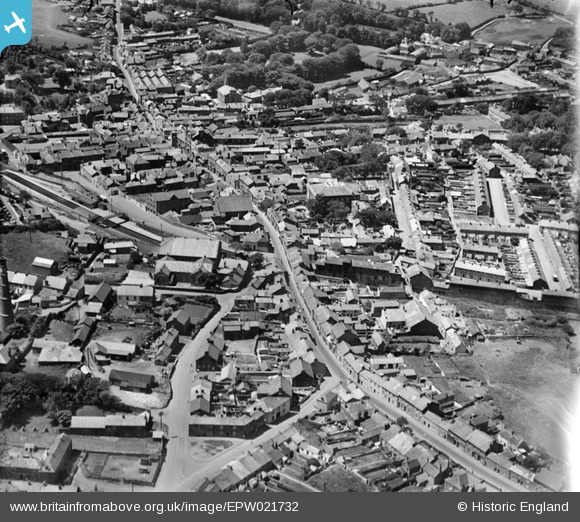
EPW021732 ENGLAND (1928). Fore Street and the town, Redruth, 1928
© Copyright OpenStreetMap contributors and licensed by the OpenStreetMap Foundation. 2026. Cartography is licensed as CC BY-SA.
Nearby Images (9)
EPW021732

EPW021730

EPW039789

EPW039786

EPW021731

EPW039787

EPW009902

EPW021734

EPW009905

Details
| Title | [EPW021732] Fore Street and the town, Redruth, 1928 |
| Reference | EPW021732 |
| Date | 24-June-1928 |
| Link | |
| Place name | REDRUTH |
| Parish | REDRUTH |
| District | |
| Country | ENGLAND |
| Easting / Northing | 170107, 42123 |
| Longitude / Latitude | -5.2240610070406, 50.233711522525 |
| National Grid Reference | SW701421 |
Pins

Andrew Roberts |
Thursday 28th of March 2024 04:27:34 PM | |
|
Pentaprism |
Saturday 31st of October 2020 01:47:31 AM | |
|
Stubzi34 |
Friday 8th of November 2013 01:53:38 PM |