
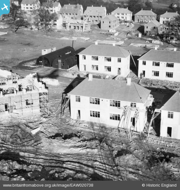
EAW020738 ENGLAND (1948). Construction of 50 and 52, 75 and 77 Ravensbury Road, St Paul's Cray, 1948
© Copyright OpenStreetMap contributors and licensed by the OpenStreetMap Foundation. 2026. Cartography is licensed as CC BY-SA.
Nearby Images (17)
EAW020738

EAW020733

EAW020739

EAW020742

EAW026809

EAW020740

EAW020741

EAW020719

EAW020737

EAW021760

EAW020720

EAW020731

EAW020718

EAW042062

EAW020730

EAW042064

EAW042061

Details
| Title | [EAW020738] Construction of 50 and 52, 75 and 77 Ravensbury Road, St Paul's Cray, 1948 |
| Reference | EAW020738 |
| Date | 24-December-1948 |
| Link | |
| Place name | ST PAUL'S CRAY |
| Parish | |
| District | |
| Country | ENGLAND |
| Easting / Northing | 546171, 168390 |
| Longitude / Latitude | 0.10131399221707, 51.395195177913 |
| National Grid Reference | TQ462684 |
Pins
Be the first to add a comment to this image!