
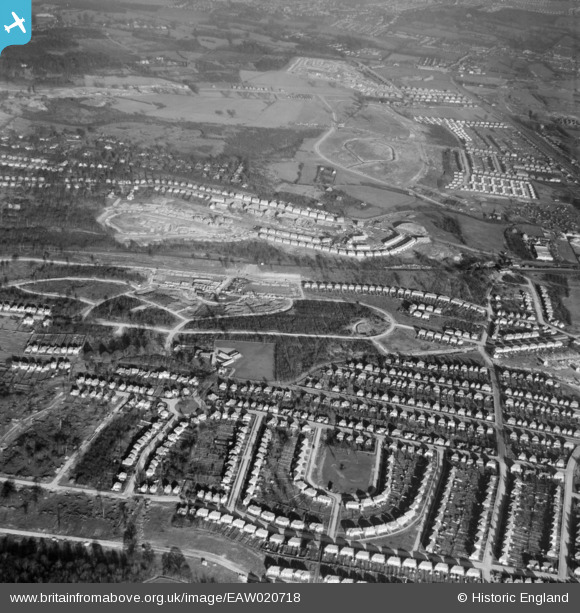
EAW020718 ENGLAND (1948). Robin Hood Green and new housing development around Tillingbourne Green and Ravensbury Road, Poverest, 1948
© Copyright OpenStreetMap contributors and licensed by the OpenStreetMap Foundation. 2026. Cartography is licensed as CC BY-SA.
Nearby Images (8)
EAW020718

EAW020731

EAW026808

EAW020742

EAW020732

EAW020721

EAW020738

EAW020719

Details
| Title | [EAW020718] Robin Hood Green and new housing development around Tillingbourne Green and Ravensbury Road, Poverest, 1948 |
| Reference | EAW020718 |
| Date | 24-December-1948 |
| Link | |
| Place name | POVEREST |
| Parish | |
| District | |
| Country | ENGLAND |
| Easting / Northing | 546211, 168146 |
| Longitude / Latitude | 0.10178808107016, 51.392992135816 |
| National Grid Reference | TQ462681 |
Pins

garyb |
Saturday 31st of May 2014 12:26:00 PM | |
|
garyb |
Saturday 31st of May 2014 12:24:34 PM | |
|
garyb |
Saturday 31st of May 2014 12:21:44 PM | |
|
garyb |
Saturday 31st of May 2014 12:12:17 PM | |
|
garyb |
Saturday 31st of May 2014 11:46:43 AM |