
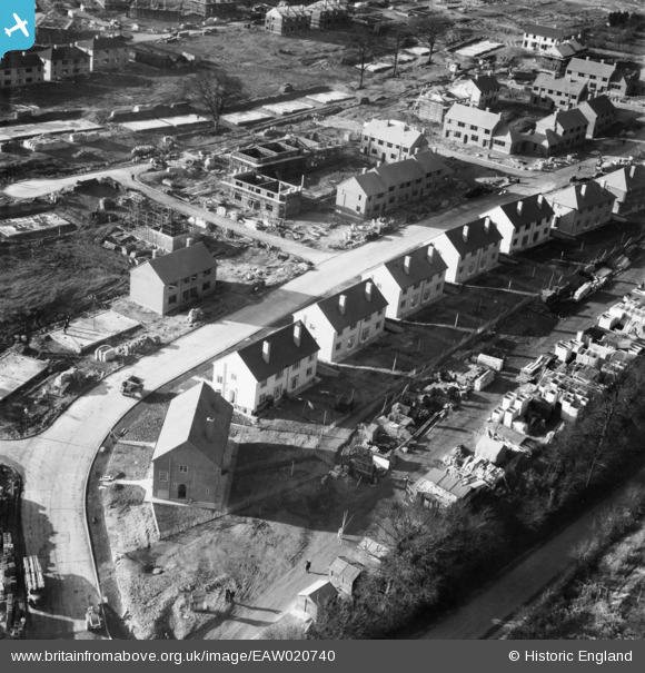
EAW020740 ENGLAND (1948). New housing on Clarendon Way, St Paul's Cray, 1948
© Copyright OpenStreetMap contributors and licensed by the OpenStreetMap Foundation. 2026. Cartography is licensed as CC BY-SA.
Nearby Images (9)
EAW020740

EAW026809

EAW020741

EAW020733

EAW042063

EAW042065

EAW021760

EAW020738

EAW020742

Details
| Title | [EAW020740] New housing on Clarendon Way, St Paul's Cray, 1948 |
| Reference | EAW020740 |
| Date | 24-December-1948 |
| Link | |
| Place name | ST PAUL'S CRAY |
| Parish | |
| District | |
| Country | ENGLAND |
| Easting / Northing | 546316, 168530 |
| Longitude / Latitude | 0.10345468887962, 51.396415920895 |
| National Grid Reference | TQ463685 |
Pins
Be the first to add a comment to this image!