
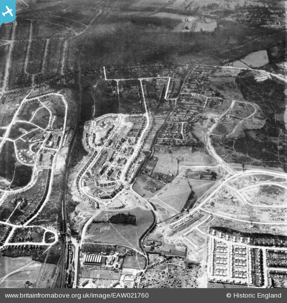
EAW021760 ENGLAND (1949). Housing estate under construction surrounding Clarendon Way and Ravensbury Road, St Paul's Cray, 1949
© Copyright OpenStreetMap contributors and licensed by the OpenStreetMap Foundation. 2026. Cartography is licensed as CC BY-SA.
Nearby Images (12)
EAW021760

EAW026809

EAW042064

EAW020730

EAW042062

EAW020733

EAW020740

EAW020739

EAW042061

EAW020738

EAW020737

EAW020741

Details
| Title | [EAW021760] Housing estate under construction surrounding Clarendon Way and Ravensbury Road, St Paul's Cray, 1949 |
| Reference | EAW021760 |
| Date | 1-April-1949 |
| Link | |
| Place name | ST PAUL'S CRAY |
| Parish | |
| District | |
| Country | ENGLAND |
| Easting / Northing | 546135, 168610 |
| Longitude / Latitude | 0.10088744062617, 51.397181508589 |
| National Grid Reference | TQ461686 |
Pins

Darren russell |
Thursday 7th of August 2014 03:51:58 PM |