
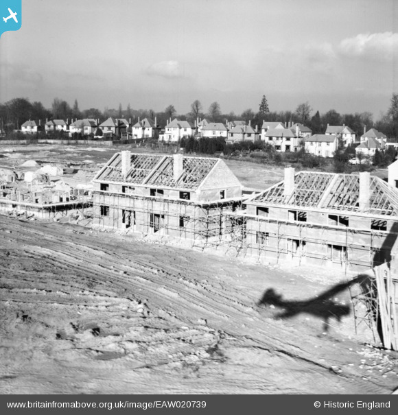
EAW020739 ENGLAND (1948). Construction of 34-40 Ravensbury Road, St Paul's Cray, from the south, 1948
© Copyright OpenStreetMap contributors and licensed by the OpenStreetMap Foundation. 2026. Cartography is licensed as CC BY-SA.
Nearby Images (14)
EAW020739

EAW020737

EAW020719

EAW020733

EAW020738

EAW020720

EAW042062

EAW020730

EAW042061

EAW020736

EAW021760

EAW042064

EAW026809

EAW026815

Details
| Title | [EAW020739] Construction of 34-40 Ravensbury Road, St Paul's Cray, from the south, 1948 |
| Reference | EAW020739 |
| Date | 24-December-1948 |
| Link | |
| Place name | ST PAUL'S CRAY |
| Parish | |
| District | |
| Country | ENGLAND |
| Easting / Northing | 546041, 168434 |
| Longitude / Latitude | 0.099464604276277, 51.395624072213 |
| National Grid Reference | TQ460684 |
Pins
Be the first to add a comment to this image!