
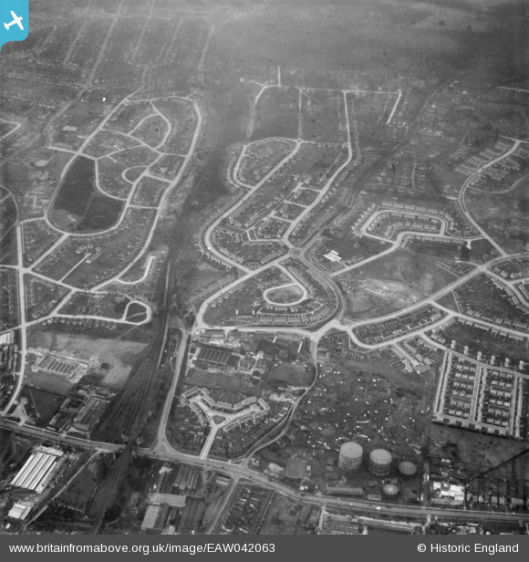
EAW042063 ENGLAND (1952). Housing estates at Poverest, Orpington, 1952
© Copyright OpenStreetMap contributors and licensed by the OpenStreetMap Foundation. 2026. Cartography is licensed as CC BY-SA.
Nearby Images (6)
EAW042063

EAW042065

EAW020722

EAW020741

EAW020740

EAW020742

Details
| Title | [EAW042063] Housing estates at Poverest, Orpington, 1952 |
| Reference | EAW042063 |
| Date | March-1952 |
| Link | |
| Place name | ORPINGTON |
| Parish | |
| District | |
| Country | ENGLAND |
| Easting / Northing | 546485, 168471 |
| Longitude / Latitude | 0.10585813358524, 51.395842095083 |
| National Grid Reference | TQ465685 |
Pins
Be the first to add a comment to this image!