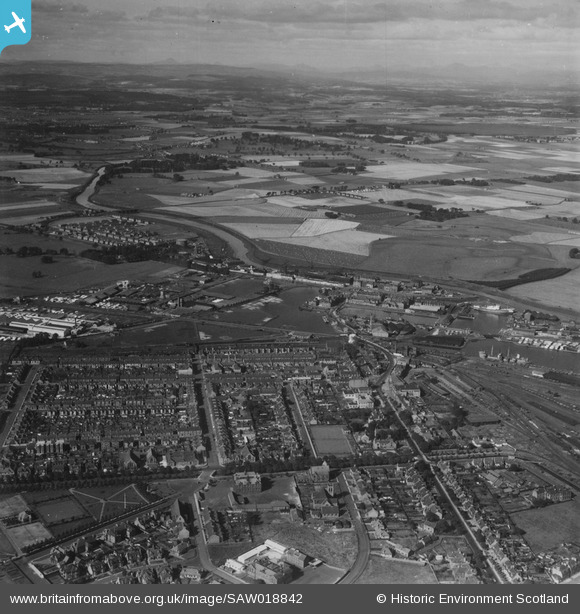
SAW018842 SCOTLAND (1948). Grangemouth, general view, showing Bo'ness Road and Grangemouth Timber Basin. An oblique aerial photograph taken facing north-west. This image has been produced from a print.
© Hawlfraint cyfranwyr OpenStreetMap a thrwyddedwyd gan yr OpenStreetMap Foundation. 2026. Trwyddedir y gartograffeg fel CC BY-SA.
Delweddau cyfagos (5)
Manylion
| Pennawd | [SAW018842] Grangemouth, general view, showing Bo'ness Road and Grangemouth Timber Basin. An oblique aerial photograph taken facing north-west. This image has been produced from a print. |
| Cyfeirnod | SAW018842 |
| Dyddiad | 1948 |
| Dolen | NRHE Collection item 1314884 |
| Enw lle | |
| Plwyf | GRANGEMOUTH |
| Ardal | FALKIRK |
| Gwlad | SCOTLAND |
| Dwyreiniad / Gogleddiad | 292080, 682160 |
| Hydred / Lledred | -3.7315508488312, 56.020233145732 |
| Cyfeirnod Grid Cenedlaethol | NS921822 |
Pinnau

cbroadley26 |
Saturday 12th of August 2023 02:34:51 AM | |

Speed |
Saturday 4th of May 2013 12:28:50 AM |


![[SAW018842] Grangemouth, general view, showing Bo'ness Road and Grangemouth Timber Basin. An oblique aerial photograph taken facing north-west. This image has been produced from a print.](http://britainfromabove.org.uk/sites/all/libraries/aerofilms-images/public/100x100/SAW/018/SAW018842.jpg)
![[SPW017715] Muirhead and Sons Ltd. Saw Mill and Brownlee and Co. Ltd. Caledonian Saw Mills, Earl's Road, Grangemouth. An oblique aerial photograph taken facing north.](http://britainfromabove.org.uk/sites/all/libraries/aerofilms-images/public/100x100/SPW/017/SPW017715.jpg)
![[SAW018841] Grangemouth, general view, showing Grangemouth Timber Basin and Skinflats. An oblique aerial photograph taken facing north-west. This image has been produced from a print.](http://britainfromabove.org.uk/sites/all/libraries/aerofilms-images/public/100x100/SAW/018/SAW018841.jpg)
![[SAW018840] Grangemouth, general view, showing Bo'ness Road and Grangemouth Timber Basin. An oblique aerial photograph taken facing north-west. This image has been produced from a print.](http://britainfromabove.org.uk/sites/all/libraries/aerofilms-images/public/100x100/SAW/018/SAW018840.jpg)
![[SPW020274] Grangemouth East Basin and Junction Dock, Grangemouth. An oblique aerial photograph taken facing north-east.](http://britainfromabove.org.uk/sites/all/libraries/aerofilms-images/public/100x100/SPW/020/SPW020274.jpg)