
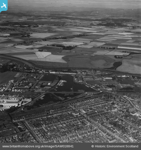
SAW018841 SCOTLAND (1948). Grangemouth, general view, showing Grangemouth Timber Basin and Skinflats. An oblique aerial photograph taken facing north-west. This image has been produced from a print.
© Hawlfraint cyfranwyr OpenStreetMap a thrwyddedwyd gan yr OpenStreetMap Foundation. 2026. Trwyddedir y gartograffeg fel CC BY-SA.
Delweddau cyfagos (4)
SAW018841

SPW020274

SAW018842

SAW018840

Manylion
| Pennawd | [SAW018841] Grangemouth, general view, showing Grangemouth Timber Basin and Skinflats. An oblique aerial photograph taken facing north-west. This image has been produced from a print. |
| Cyfeirnod | SAW018841 |
| Dyddiad | 1948 |
| Dolen | NRHE Collection item 1314883 |
| Enw lle | |
| Plwyf | GRANGEMOUTH |
| Ardal | FALKIRK |
| Gwlad | SCOTLAND |
| Dwyreiniad / Gogleddiad | 292170, 682340 |
| Hydred / Lledred | -3.7301798659523, 56.021870092191 |
| Cyfeirnod Grid Cenedlaethol | NS922823 |
Pinnau
Byddwch y cyntaf i ychwanegu sylw at y ddelwedd hon!