
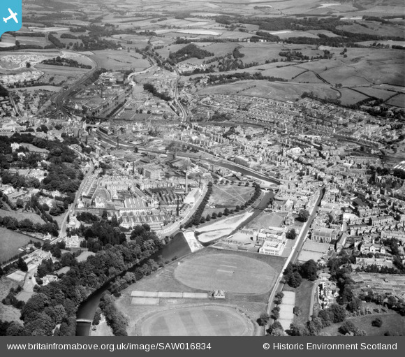
SAW016834 SCOTLAND (1948). Hawick, general view, showing Upper Common Haugh and Weensland Road. An oblique aerial photograph taken facing north-east.
© Hawlfraint cyfranwyr OpenStreetMap a thrwyddedwyd gan yr OpenStreetMap Foundation. 2026. Trwyddedir y gartograffeg fel CC BY-SA.
Delweddau cyfagos (7)
SAW016834

SPW042483

SAW016833

SPW042484

SAW016835

SAW016832

SAW016831

Manylion
| Pennawd | [SAW016834] Hawick, general view, showing Upper Common Haugh and Weensland Road. An oblique aerial photograph taken facing north-east. |
| Cyfeirnod | SAW016834 |
| Dyddiad | 1948 |
| Dolen | NRHE Collection item 1269046 |
| Enw lle | |
| Plwyf | HAWICK |
| Ardal | ROXBURGH |
| Gwlad | SCOTLAND |
| Dwyreiniad / Gogleddiad | 350200, 614750 |
| Hydred / Lledred | -2.7869136562609, 55.424099253857 |
| Cyfeirnod Grid Cenedlaethol | NT502148 |

