
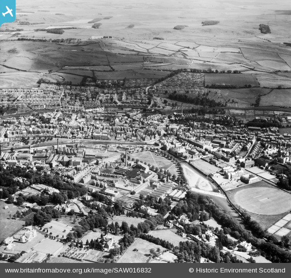
SAW016832 SCOTLAND (1948). Hawick, general view, showing Upper Common Haugh and Hawick High School, Buccleuch Road. An oblique aerial photograph taken facing south-east.
© Hawlfraint cyfranwyr OpenStreetMap a thrwyddedwyd gan yr OpenStreetMap Foundation. 2026. Trwyddedir y gartograffeg fel CC BY-SA.
Delweddau cyfagos (5)
SAW016832

SAW016835

SAW016834

SAW016833

SPW042484

Manylion
| Pennawd | [SAW016832] Hawick, general view, showing Upper Common Haugh and Hawick High School, Buccleuch Road. An oblique aerial photograph taken facing south-east. |
| Cyfeirnod | SAW016832 |
| Dyddiad | 1948 |
| Dolen | NRHE Collection item 1269044 |
| Enw lle | |
| Plwyf | HAWICK |
| Ardal | ROXBURGH |
| Gwlad | SCOTLAND |
| Dwyreiniad / Gogleddiad | 350227, 614523 |
| Hydred / Lledred | -2.7864465250142, 55.422062232324 |
| Cyfeirnod Grid Cenedlaethol | NT502145 |
Pinnau

redmist |
Sunday 5th of June 2022 11:42:13 PM |