
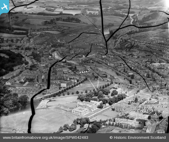
SPW042483 SCOTLAND (1933). Hawick, general view, showing Upper Common Haugh and Princes Street. An oblique aerial photograph taken facing north-east. This image has been produced from a damaged negative.
© Hawlfraint cyfranwyr OpenStreetMap a thrwyddedwyd gan yr OpenStreetMap Foundation. 2026. Trwyddedir y gartograffeg fel CC BY-SA.
Delweddau cyfagos (5)
SPW042483

SAW016834

SAW016833

SPW042484

SAW016831

Manylion
| Pennawd | [SPW042483] Hawick, general view, showing Upper Common Haugh and Princes Street. An oblique aerial photograph taken facing north-east. This image has been produced from a damaged negative. |
| Cyfeirnod | SPW042483 |
| Dyddiad | 1933 |
| Dolen | NRHE Collection item 1257945 |
| Enw lle | |
| Plwyf | HAWICK |
| Ardal | ROXBURGH |
| Gwlad | SCOTLAND |
| Dwyreiniad / Gogleddiad | 350200, 614810 |
| Hydred / Lledred | -2.7869243773779, 55.424638398502 |
| Cyfeirnod Grid Cenedlaethol | NT502148 |
Pinnau

slowcoach |
Saturday 23rd of November 2013 01:00:46 AM |
Cyfraniadau Grŵp
HAWICK FROM THE COMMON HAUGH |
davyblake |
Thursday 22nd of January 2015 09:22:28 AM |