
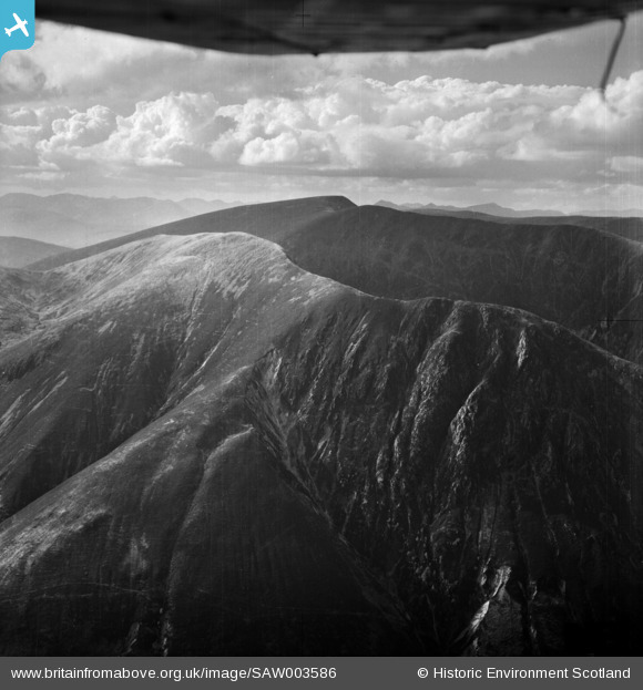
SAW003586 SCOTLAND (1947) [Unlocated]. Unlocated mountains, possibly near Ben Nevis. An oblique aerial photograph.
© Hawlfraint cyfranwyr OpenStreetMap a thrwyddedwyd gan yr OpenStreetMap Foundation. 2026. Trwyddedir y gartograffeg fel CC BY-SA.
Delweddau cyfagos (48)
EPW000143

EPW000667

EPW005260

EPW006389
, 1921")
EPW007181

EPW015853

EPW015854

EPW015855

EPW016012

EPW016510

EPW016641

EPW017028

EPW017029

EPW017136

SAW003585

SAW003586

SAW009337

SAW009800

SAW009801

SAW009802

SAW010734

SAW014737

SAW017926

SAW017927

SAW032504

SPW020275

SPW020280

SPW020281

SPW020284

SPW020632

SPW020633

SPW027083

SPW049776

SPW049777

SPW049779

SPW049783

SPW049791

SPW049798

SPW049801

SPW049827

SPW049828

SPW049831

SPW049832

SPW049834

SPW049948

SPW049949

SPW051009

SPW062638

Manylion
| Pennawd | [SAW003586] Unlocated mountains, possibly near Ben Nevis. An oblique aerial photograph. |
| Cyfeirnod | SAW003586 |
| Dyddiad | 1947 |
| Dolen | NRHE Collection item 1268502 |
| Enw lle | |
| Plwyf | |
| Ardal | |
| Gwlad | SCOTLAND |
| Dwyreiniad / Gogleddiad | 0, 0 |
| Hydred / Lledred | -7.556448482059, 49.766185796754 |
| Cyfeirnod Grid Cenedlaethol | SV000000 |
Pinnau

Mike Holder |
Saturday 22nd of September 2018 12:48:41 PM | |
For anyone seeing this and struggling to locate it on a map, the photo is taken from very roughly (56°59'24"N 4°54'25"W) looking North West. It took me quite a while to get my bearings from the pins that were added by Mike Holder. I uploaded a gif here (https://imgur.com/a/ObgIxJc) showing an overlay of the photo which confirms Mike's pins. |
qeorge |
Saturday 25th of March 2023 02:04:19 PM |
 |
Mike Holder |
Tuesday 13th of February 2018 10:02:34 AM |
|
Mike Holder |
Monday 12th of February 2018 02:58:06 PM | |
|
Mike Holder |
Monday 12th of February 2018 02:57:16 PM | |
|
Mike Holder |
Monday 12th of February 2018 02:55:10 PM | |
|
Mike Holder |
Monday 12th of February 2018 02:54:32 PM | |
|
Calchfaen |
Sunday 25th of November 2012 04:24:26 PM |
Cyfraniadau Grŵp
North (or northeast) is probably off to the right of this shot - as suggested both by the lighting/shadows and the fact that the majority of glaciated cirques face somewhere between N and E. The patterns of gully erosion and smooth slopes suggest a mix of igneous rocks including perhaps granite, evidenced by the light-coloured stone field on the upper slopes. Looks like parts of the Mamores or Grey Corries but a match is difficult to make, so other search areas must come into play. |
Calchfaen |
Sunday 25th of November 2012 04:23:49 PM |