
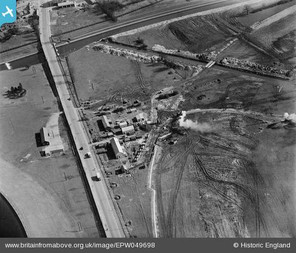
EPW049698 ENGLAND (1936). The site of the northern end of the William Girling Reservoir showing preliminary construction works, Ponders End, 1936
© Hawlfraint cyfranwyr OpenStreetMap a thrwyddedwyd gan yr OpenStreetMap Foundation. 2026. Trwyddedir y gartograffeg fel CC BY-SA.
Delweddau cyfagos (7)
EPW049698

EAW040929

EPW049522

EPW049716

EAW040925

EAW043545

EPW060221
 Reservoir under construction, Edmonton, from the north-east, 1938")
Manylion
| Pennawd | [EPW049698] The site of the northern end of the William Girling Reservoir showing preliminary construction works, Ponders End, 1936 |
| Cyfeirnod | EPW049698 |
| Dyddiad | March-1936 |
| Dolen | |
| Enw lle | PONDERS END |
| Plwyf | |
| Ardal | |
| Gwlad | ENGLAND |
| Dwyreiniad / Gogleddiad | 537213, 194907 |
| Hydred / Lledred | -0.017053839790805, 51.6357442493 |
| Cyfeirnod Grid Cenedlaethol | TQ372949 |
Pinnau
Byddwch y cyntaf i ychwanegu sylw at y ddelwedd hon!