
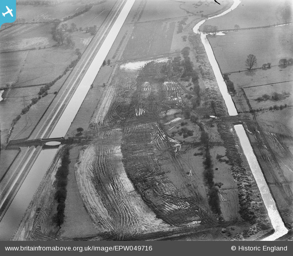
EPW049716 ENGLAND (1936). The site of the northern end of the William Girling Reservoir showing preliminary construction works, Ponders End, 1936
© Hawlfraint cyfranwyr OpenStreetMap a thrwyddedwyd gan yr OpenStreetMap Foundation. 2026. Trwyddedir y gartograffeg fel CC BY-SA.
Delweddau cyfagos (11)
EPW049716

EAW040928

EAW040925

EAW040929

EPW049718

EPW049698

EPW049524

EPW049522

EPW060639

EPW052689

EPW055971

Manylion
| Pennawd | [EPW049716] The site of the northern end of the William Girling Reservoir showing preliminary construction works, Ponders End, 1936 |
| Cyfeirnod | EPW049716 |
| Dyddiad | March-1936 |
| Dolen | |
| Enw lle | PONDERS END |
| Plwyf | |
| Ardal | |
| Gwlad | ENGLAND |
| Dwyreiniad / Gogleddiad | 537159, 194695 |
| Hydred / Lledred | -0.017916803252922, 51.633852195167 |
| Cyfeirnod Grid Cenedlaethol | TQ372947 |
Pinnau
Byddwch y cyntaf i ychwanegu sylw at y ddelwedd hon!