
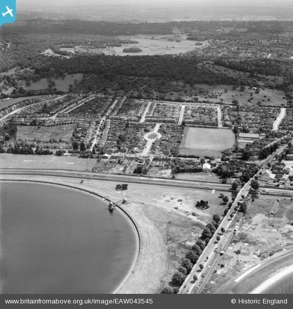
EAW043545 ENGLAND (1952). Housing estate around Amesbury Drive between King George's Reservoir and Pole Hill, Ponders End, from the west, 1952
© Hawlfraint cyfranwyr OpenStreetMap a thrwyddedwyd gan yr OpenStreetMap Foundation. 2026. Trwyddedir y gartograffeg fel CC BY-SA.
Delweddau cyfagos (5)
EAW043545

EPW060221
 Reservoir under construction, Edmonton, from the north-east, 1938")
EAW043546

EPW049522

EPW049698

Manylion
| Pennawd | [EAW043545] Housing estate around Amesbury Drive between King George's Reservoir and Pole Hill, Ponders End, from the west, 1952 |
| Cyfeirnod | EAW043545 |
| Dyddiad | 4-June-1952 |
| Dolen | |
| Enw lle | PONDERS END |
| Plwyf | |
| Ardal | |
| Gwlad | ENGLAND |
| Dwyreiniad / Gogleddiad | 537441, 195092 |
| Hydred / Lledred | -0.013688351960959, 51.637351152866 |
| Cyfeirnod Grid Cenedlaethol | TQ374951 |
Pinnau
 |

redmist |
Tuesday 2nd of November 2021 09:08:30 PM |