
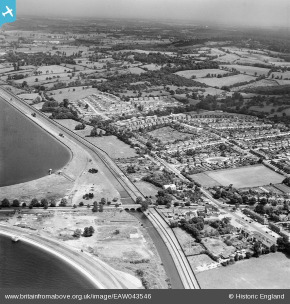
EAW043546 ENGLAND (1952). Housing estate between Lea Valley Road and Yardley Hill, Chingford, from the south-west, 1952
© Hawlfraint cyfranwyr OpenStreetMap a thrwyddedwyd gan yr OpenStreetMap Foundation. 2026. Trwyddedir y gartograffeg fel CC BY-SA.
Delweddau cyfagos (4)
EAW043546

EPW060221
 Reservoir under construction, Edmonton, from the north-east, 1938")
EAW043545

EPW049522

Manylion
| Pennawd | [EAW043546] Housing estate between Lea Valley Road and Yardley Hill, Chingford, from the south-west, 1952 |
| Cyfeirnod | EAW043546 |
| Dyddiad | 4-June-1952 |
| Dolen | |
| Enw lle | CHINGFORD |
| Plwyf | |
| Ardal | |
| Gwlad | ENGLAND |
| Dwyreiniad / Gogleddiad | 537506, 194975 |
| Hydred / Lledred | -0.012795546060398, 51.636283798558 |
| Cyfeirnod Grid Cenedlaethol | TQ375950 |
