
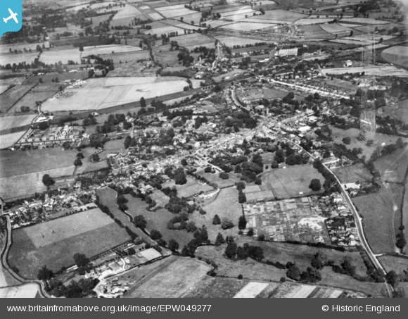
EPW049277 ENGLAND (1935). The town, Witham, 1935. This image has been produced from a copy-negative.
© Hawlfraint cyfranwyr OpenStreetMap a thrwyddedwyd gan yr OpenStreetMap Foundation. 2026. Trwyddedir y gartograffeg fel CC BY-SA.
Delweddau cyfagos (8)
EPW049277

EAW021826

EPW046364

EPW046365

EPW046367

EPW046366

EAW021827

EAW021825

Manylion
| Pennawd | [EPW049277] The town, Witham, 1935. This image has been produced from a copy-negative. |
| Cyfeirnod | EPW049277 |
| Dyddiad | September-1935 |
| Dolen | |
| Enw lle | WITHAM |
| Plwyf | WITHAM |
| Ardal | |
| Gwlad | ENGLAND |
| Dwyreiniad / Gogleddiad | 582022, 214397 |
| Hydred / Lledred | 0.64004278002463, 51.798103075781 |
| Cyfeirnod Grid Cenedlaethol | TL820144 |
Pinnau
Byddwch y cyntaf i ychwanegu sylw at y ddelwedd hon!