
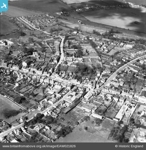
EAW021826 ENGLAND (1949). Guithavon Street, Newland Street and environs, Witham, 1949. This image has been produced from a print.
© Hawlfraint cyfranwyr OpenStreetMap a thrwyddedwyd gan yr OpenStreetMap Foundation. 2026. Trwyddedir y gartograffeg fel CC BY-SA.
Delweddau cyfagos (8)
EAW021826

EAW021825

EAW021827

EPW046364

EPW046366

EPW046365

EPW049277

EPW046367

Manylion
| Pennawd | [EAW021826] Guithavon Street, Newland Street and environs, Witham, 1949. This image has been produced from a print. |
| Cyfeirnod | EAW021826 |
| Dyddiad | 9-April-1949 |
| Dolen | |
| Enw lle | WITHAM |
| Plwyf | WITHAM |
| Ardal | |
| Gwlad | ENGLAND |
| Dwyreiniad / Gogleddiad | 582063, 214553 |
| Hydred / Lledred | 0.64071867573339, 51.799490998092 |
| Cyfeirnod Grid Cenedlaethol | TL821146 |
Pinnau

matt |
Wednesday 8th of April 2020 06:25:50 PM |