
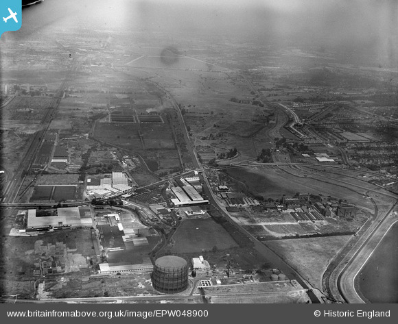
EPW048900 ENGLAND (1935). The Gothic Gas Meters and Stove Works, the Sparklet Works and the site of the William Girling Reservoir, Upper Edmonton, from the south, 1935
© Hawlfraint cyfranwyr OpenStreetMap a thrwyddedwyd gan yr OpenStreetMap Foundation. 2026. Trwyddedir y gartograffeg fel CC BY-SA.
Delweddau cyfagos (17)
EPW048900

EPW049728
 and other factories, Edmonton, 1936")
EPW032037

EPW049521

EPW049520

EPW032042

EPW032038

EPW048901

EPW032039

EPW032762

EPW044758

EPW044760

EPW032759

EPW044759

EPW044750

EPW044752

EPW044749

Manylion
| Pennawd | [EPW048900] The Gothic Gas Meters and Stove Works, the Sparklet Works and the site of the William Girling Reservoir, Upper Edmonton, from the south, 1935 |
| Cyfeirnod | EPW048900 |
| Dyddiad | August-1935 |
| Dolen | |
| Enw lle | UPPER EDMONTON |
| Plwyf | |
| Ardal | |
| Gwlad | ENGLAND |
| Dwyreiniad / Gogleddiad | 535649, 191865 |
| Hydred / Lledred | -0.040819963883528, 51.608785025954 |
| Cyfeirnod Grid Cenedlaethol | TQ356919 |
Pinnau
Byddwch y cyntaf i ychwanegu sylw at y ddelwedd hon!