
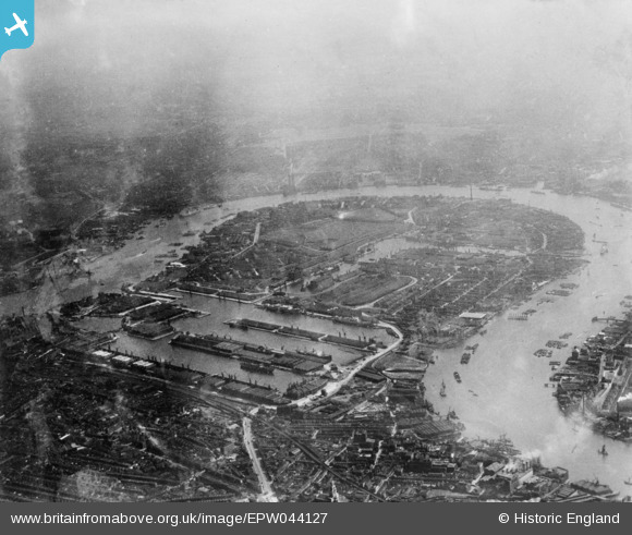
EPW044127 ENGLAND (1934). West India and Millwall Docks, Isle of Dogs, from the north, 1934. This image has been produced from a copy-negative.
© Hawlfraint cyfranwyr OpenStreetMap a thrwyddedwyd gan yr OpenStreetMap Foundation. 2026. Trwyddedir y gartograffeg fel CC BY-SA.
Delweddau cyfagos (8)
EPW044127

EPW059929

EPW044129

EPW059930

EPW005993
, Canary Wharf, 1921")
EPW045543

EPW024258

EPW059926

Manylion
| Pennawd | [EPW044127] West India and Millwall Docks, Isle of Dogs, from the north, 1934. This image has been produced from a copy-negative. |
| Cyfeirnod | EPW044127 |
| Dyddiad | May-1934 |
| Dolen | |
| Enw lle | ISLE OF DOGS |
| Plwyf | |
| Ardal | |
| Gwlad | ENGLAND |
| Dwyreiniad / Gogleddiad | 537386, 180258 |
| Hydred / Lledred | -0.020284115562209, 51.504051285671 |
| Cyfeirnod Grid Cenedlaethol | TQ374803 |
Pinnau

Robin |
Saturday 7th of December 2024 08:04:21 PM | |
|
redmist |
Thursday 4th of November 2021 09:02:28 AM | |
|
redmist |
Thursday 4th of November 2021 09:02:04 AM | |
|
redmist |
Thursday 4th of November 2021 09:01:07 AM | |
|
redmist |
Thursday 4th of November 2021 08:57:04 AM | |
|
redmist |
Thursday 4th of November 2021 08:56:42 AM | |
|
redmist |
Thursday 4th of November 2021 08:55:44 AM |