
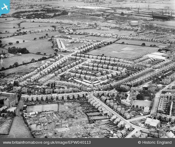
EPW040113 ENGLAND (1932). Ruskin Park Estate around Tynedale Avenue, Crewe, 1932
© Hawlfraint cyfranwyr OpenStreetMap a thrwyddedwyd gan yr OpenStreetMap Foundation. 2026. Trwyddedir y gartograffeg fel CC BY-SA.
Delweddau cyfagos (3)
EPW040113

EPW040112

EPW040111

Manylion
| Pennawd | [EPW040113] Ruskin Park Estate around Tynedale Avenue, Crewe, 1932 |
| Cyfeirnod | EPW040113 |
| Dyddiad | September-1932 |
| Dolen | |
| Enw lle | CREWE |
| Plwyf | |
| Ardal | |
| Gwlad | ENGLAND |
| Dwyreiniad / Gogleddiad | 370008, 354642 |
| Hydred / Lledred | -2.4478594912151, 53.087851185647 |
| Cyfeirnod Grid Cenedlaethol | SJ700546 |
Pinnau

chalcanthite |
Saturday 9th of November 2019 10:29:51 PM | |
|
Crewedaddy |
Wednesday 13th of September 2017 12:52:26 AM | |
|
Crewedaddy |
Wednesday 13th of September 2017 12:51:45 AM |