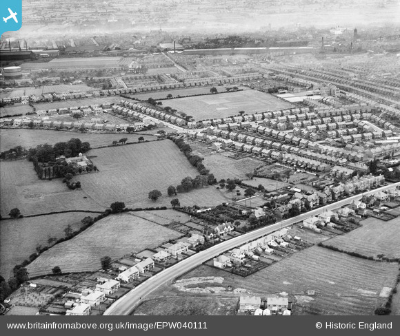
EPW040111 ENGLAND (1932). Nantwich Road and the Ruskin Park Estate, Crewe, 1932
    © Hawlfraint cyfranwyr OpenStreetMap a thrwyddedwyd gan yr OpenStreetMap Foundation. 2025. Trwyddedir y gartograffeg fel CC BY-SA.
  
Manylion
| Pennawd | [EPW040111] Nantwich Road and the Ruskin Park Estate, Crewe, 1932 | 
| Cyfeirnod | EPW040111 | 
| Dyddiad | October-1932 | 
| Dolen | |
| Enw lle | CREWE | 
| Plwyf | |
| Ardal | |
| Gwlad | ENGLAND | 
| Dwyreiniad / Gogleddiad | 369811, 354594 | 
| Hydred / Lledred | -2.4507966114536, 53.087408569956 | 
| Cyfeirnod Grid Cenedlaethol | SJ698546 | 
Pinnau
|  Nantwich Road 1932 |   mollymeg | Wednesday 13th of January 2021 02:33:02 PM | 
 
             
  ![[EPW040111] Nantwich Road and the Ruskin Park Estate, Crewe, 1932](http://britainfromabove.org.uk/sites/all/libraries/aerofilms-images/public/100x100/EPW/040/EPW040111.jpg) 
  
                                          ![[EPW040112] Ruskin Park Estate around Somerville Street, Crewe, 1932](http://britainfromabove.org.uk/sites/all/libraries/aerofilms-images/public/100x100/EPW/040/EPW040112.jpg) 
 ![[EPW040109] Ruskin Park Estate around Lunt Avenue, Crewe, 1932](http://britainfromabove.org.uk/sites/all/libraries/aerofilms-images/public/100x100/EPW/040/EPW040109.jpg) 
 ![[EPW040113] Ruskin Park Estate around Tynedale Avenue, Crewe, 1932](http://britainfromabove.org.uk/sites/all/libraries/aerofilms-images/public/100x100/EPW/040/EPW040113.jpg)