
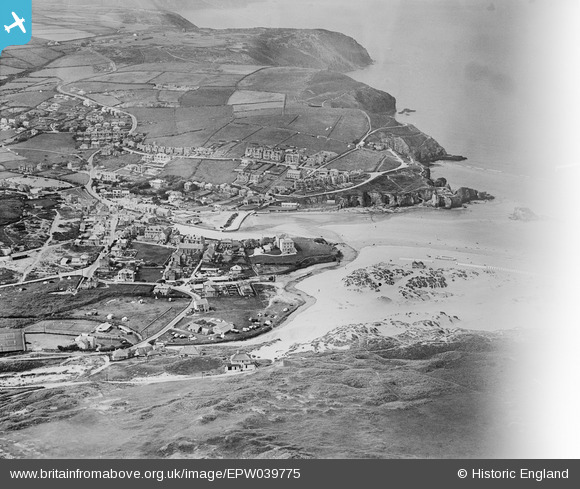
EPW039775 ENGLAND (1932). Perran Beach, the town and adjacent coastline, Perranporth, 1932. This image has been affected by flare.
© Hawlfraint cyfranwyr OpenStreetMap a thrwyddedwyd gan yr OpenStreetMap Foundation. 2026. Trwyddedir y gartograffeg fel CC BY-SA.
Delweddau cyfagos (5)
EPW039775

EPW007156A

EPW039772

EPW039776

EPW039773

Manylion
| Pennawd | [EPW039775] Perran Beach, the town and adjacent coastline, Perranporth, 1932. This image has been affected by flare. |
| Cyfeirnod | EPW039775 |
| Dyddiad | August-1932 |
| Dolen | |
| Enw lle | PERRANPORTH |
| Plwyf | PERRANZABULOE |
| Ardal | |
| Gwlad | ENGLAND |
| Dwyreiniad / Gogleddiad | 175695, 54425 |
| Hydred / Lledred | -5.1531208473812, 50.346339477586 |
| Cyfeirnod Grid Cenedlaethol | SW757544 |
Pinnau
Byddwch y cyntaf i ychwanegu sylw at y ddelwedd hon!