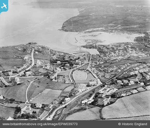
EPW039773 ENGLAND (1932). Boscawen Gardens, Reen Sands and the town, Perranporth, 1932
    © Hawlfraint cyfranwyr OpenStreetMap a thrwyddedwyd gan yr OpenStreetMap Foundation. 2025. Trwyddedir y gartograffeg fel CC BY-SA.
  
Delweddau cyfagos (5)
Manylion
| Pennawd | [EPW039773] Boscawen Gardens, Reen Sands and the town, Perranporth, 1932 | 
| Cyfeirnod | EPW039773 | 
| Dyddiad | August-1932 | 
| Dolen | |
| Enw lle | PERRANPORTH | 
| Plwyf | PERRANZABULOE | 
| Ardal | |
| Gwlad | ENGLAND | 
| Dwyreiniad / Gogleddiad | 175624, 54196 | 
| Hydred / Lledred | -5.1539809600204, 50.344255860791 | 
| Cyfeirnod Grid Cenedlaethol | SW756542 | 
Pinnau
|  Perranporth Beach Halt Railway Station. | Cabby | Saturday 15th of March 2014 07:56:32 PM | 
 
             
  ![[EPW039773] Boscawen Gardens, Reen Sands and the town, Perranporth, 1932](http://britainfromabove.org.uk/sites/all/libraries/aerofilms-images/public/100x100/EPW/039/EPW039773.jpg) 
  
                                          ![[EPW039774] The town and surrounding countryside, Perranporth, 1932](http://britainfromabove.org.uk/sites/all/libraries/aerofilms-images/public/100x100/EPW/039/EPW039774.jpg) 
 ![[EPW039772] Perran Beach, Chapel Rock and the town, Perranporth, 1932](http://britainfromabove.org.uk/sites/all/libraries/aerofilms-images/public/100x100/EPW/039/EPW039772.jpg) 
 ![[EPW007156A] The village centre, Perranporth, 1921](http://britainfromabove.org.uk/sites/all/libraries/aerofilms-images/public/100x100/EPW/007/EPW007156A.jpg) 
 ![[EPW039775] Perran Beach, the town and adjacent coastline, Perranporth, 1932. This image has been affected by flare.](http://britainfromabove.org.uk/sites/all/libraries/aerofilms-images/public/100x100/EPW/039/EPW039775.jpg)