
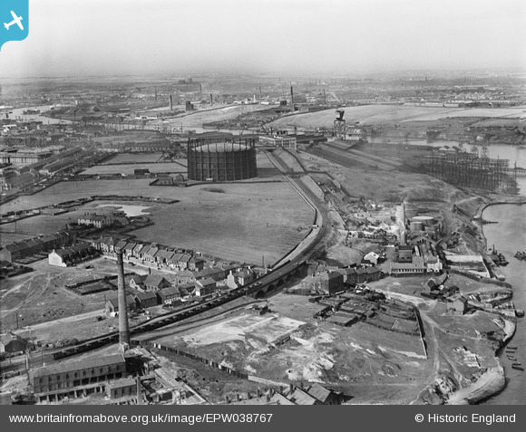
EPW038767 ENGLAND (1932). Windhill Road Gasometer and surrounding industry on the River Tyne, St Anthony's, from the south-west, 1932
© Hawlfraint cyfranwyr OpenStreetMap a thrwyddedwyd gan yr OpenStreetMap Foundation. 2025. Trwyddedir y gartograffeg fel CC BY-SA.
Delweddau cyfagos (4)
EPW038767

EPW038768

EPW038769

EPW038763

Manylion
| Pennawd | [EPW038767] Windhill Road Gasometer and surrounding industry on the River Tyne, St Anthony's, from the south-west, 1932 |
| Cyfeirnod | EPW038767 |
| Dyddiad | June-1932 |
| Dolen | |
| Enw lle | ST ANTHONY'S |
| Plwyf | |
| Ardal | |
| Gwlad | ENGLAND |
| Dwyreiniad / Gogleddiad | 428798, 563068 |
| Hydred / Lledred | -1.550197225518, 54.961335349155 |
| Cyfeirnod Grid Cenedlaethol | NZ288631 |
Pinnau

Porcy |
Monday 12th of June 2017 10:24:51 PM | |
|
Porcy |
Monday 12th of June 2017 10:23:53 PM | |
|
Porcy |
Monday 12th of June 2017 10:23:02 PM | |
|
Porcy |
Monday 12th of June 2017 10:19:31 PM | |
|
Porcy |
Monday 12th of June 2017 10:17:25 PM | |
|
Porcy |
Monday 12th of June 2017 10:13:56 PM | |
|
Porcy |
Monday 12th of June 2017 10:12:51 PM |