
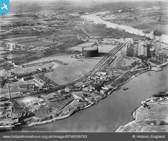
EPW038763 ENGLAND (1932). Windhill Road Gasometer and surrounding industry on the River Tyne, St Anthony's, 1932
© Hawlfraint cyfranwyr OpenStreetMap a thrwyddedwyd gan yr OpenStreetMap Foundation. 2025. Trwyddedir y gartograffeg fel CC BY-SA.
Delweddau cyfagos (6)
EPW038763

EPW038766

EPW038769

EPW038765

EPW038764

EPW038767

Manylion
| Pennawd | [EPW038763] Windhill Road Gasometer and surrounding industry on the River Tyne, St Anthony's, 1932 |
| Cyfeirnod | EPW038763 |
| Dyddiad | June-1932 |
| Dolen | |
| Enw lle | ST ANTHONY'S |
| Plwyf | |
| Ardal | |
| Gwlad | ENGLAND |
| Dwyreiniad / Gogleddiad | 429038, 563291 |
| Hydred / Lledred | -1.5464261629832, 54.963325526717 |
| Cyfeirnod Grid Cenedlaethol | NZ290633 |
