
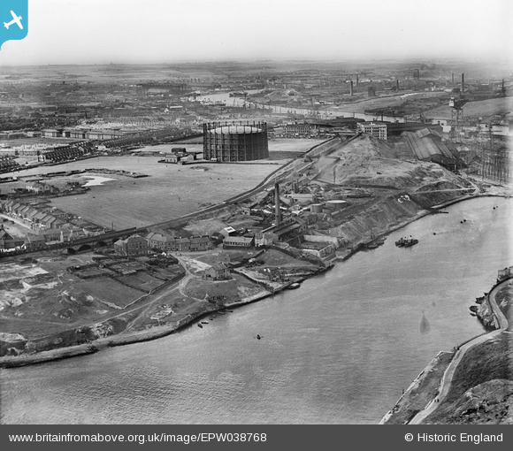
EPW038768 ENGLAND (1932). Windhill Road Gasometer and surrounding industry on the River Tyne, St Anthony's, from the south-west, 1932
© Hawlfraint cyfranwyr OpenStreetMap a thrwyddedwyd gan yr OpenStreetMap Foundation. 2025. Trwyddedir y gartograffeg fel CC BY-SA.
Delweddau cyfagos (2)
EPW038768

EPW038767

Manylion
| Pennawd | [EPW038768] Windhill Road Gasometer and surrounding industry on the River Tyne, St Anthony's, from the south-west, 1932 |
| Cyfeirnod | EPW038768 |
| Dyddiad | June-1932 |
| Dolen | |
| Enw lle | ST ANTHONY'S |
| Plwyf | |
| Ardal | |
| Gwlad | ENGLAND |
| Dwyreiniad / Gogleddiad | 428886, 562940 |
| Hydred / Lledred | -1.548835669481, 54.960179922054 |
| Cyfeirnod Grid Cenedlaethol | NZ289629 |
Pinnau
Byddwch y cyntaf i ychwanegu sylw at y ddelwedd hon!