
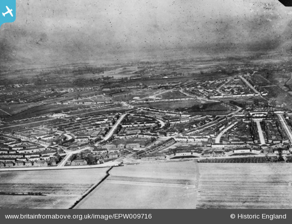
EPW009716 ENGLAND (1923). The Becontree Estate around Campden Crescent and Bennett's Castle Lane, Becontree, from the south, 1923. This image has been produced from a copy-negative.
© Hawlfraint cyfranwyr OpenStreetMap a thrwyddedwyd gan yr OpenStreetMap Foundation. 2026. Trwyddedir y gartograffeg fel CC BY-SA.
Delweddau cyfagos (5)
EPW009716

EPW009714

EPW009713

EPW009711

EPW009712

Manylion
| Pennawd | [EPW009716] The Becontree Estate around Campden Crescent and Bennett's Castle Lane, Becontree, from the south, 1923. This image has been produced from a copy-negative. |
| Cyfeirnod | EPW009716 |
| Dyddiad | 1923 |
| Dolen | |
| Enw lle | BECONTREE |
| Plwyf | |
| Ardal | |
| Gwlad | ENGLAND |
| Dwyreiniad / Gogleddiad | 547410, 185813 |
| Hydred / Lledred | 0.12638240430143, 51.551444112788 |
| Cyfeirnod Grid Cenedlaethol | TQ474858 |
