
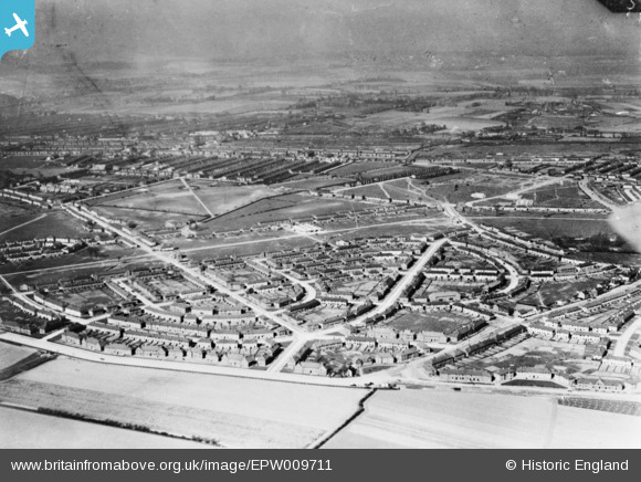
EPW009711 ENGLAND (1923). The Becontree Estate around Campden Crescent and Fuller Road, Becontree, from the south, 1923. This image has been produced from a copy-negative.
© Hawlfraint cyfranwyr OpenStreetMap a thrwyddedwyd gan yr OpenStreetMap Foundation. 2026. Trwyddedir y gartograffeg fel CC BY-SA.
Delweddau cyfagos (4)
EPW009711

EPW009712

EPW009716

EPW024285

Manylion
| Pennawd | [EPW009711] The Becontree Estate around Campden Crescent and Fuller Road, Becontree, from the south, 1923. This image has been produced from a copy-negative. |
| Cyfeirnod | EPW009711 |
| Dyddiad | 1923 |
| Dolen | |
| Enw lle | BECONTREE |
| Plwyf | |
| Ardal | |
| Gwlad | ENGLAND |
| Dwyreiniad / Gogleddiad | 547216, 185910 |
| Hydred / Lledred | 0.12362663797844, 51.552366438774 |
| Cyfeirnod Grid Cenedlaethol | TQ472859 |
Pinnau

Chelsea61 |
Wednesday 1st of October 2014 01:29:05 PM | |
|
Chelsea61 |
Wednesday 1st of October 2014 01:28:48 PM | |
|
Chelsea61 |
Wednesday 1st of October 2014 01:28:09 PM | |
|
Chelsea61 |
Wednesday 1st of October 2014 01:27:14 PM | |
|
Chelsea61 |
Wednesday 1st of October 2014 01:26:51 PM | |
|
Chelsea61 |
Wednesday 1st of October 2014 01:26:22 PM |