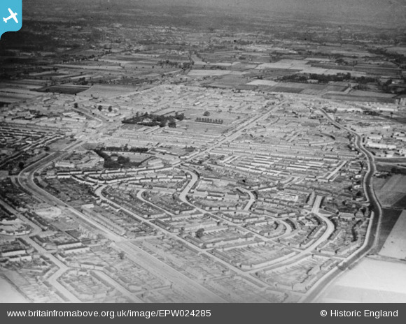
EPW024285 ENGLAND (1928). The Becontree Estate, Becontree, from the west, 1928. This image has been produced from a copy-negative.
    © Hawlfraint cyfranwyr OpenStreetMap a thrwyddedwyd gan yr OpenStreetMap Foundation. 2025. Trwyddedir y gartograffeg fel CC BY-SA.
  
Delweddau cyfagos (5)
Manylion
| Pennawd | [EPW024285] The Becontree Estate, Becontree, from the west, 1928. This image has been produced from a copy-negative. | 
| Cyfeirnod | EPW024285 | 
| Dyddiad | October-1928 | 
| Dolen | |
| Enw lle | BECONTREE | 
| Plwyf | |
| Ardal | |
| Gwlad | ENGLAND | 
| Dwyreiniad / Gogleddiad | 547040, 186044 | 
| Hydred / Lledred | 0.12114569819242, 51.553616500926 | 
| Cyfeirnod Grid Cenedlaethol | TQ470860 | 
Pinnau
Byddwch y cyntaf i ychwanegu sylw at y ddelwedd hon!
 
             
  ![[EPW024285] The Becontree Estate, Becontree, from the west, 1928. This image has been produced from a copy-negative.](http://britainfromabove.org.uk/sites/all/libraries/aerofilms-images/public/100x100/EPW/024/EPW024285.jpg) 
  
                                          ![[EPW024286] Housing surrounding Becontree Avenue, Becontree, from the south-west, 1928](http://britainfromabove.org.uk/sites/all/libraries/aerofilms-images/public/100x100/EPW/024/EPW024286.jpg) 
 ![[EPW009711] The Becontree Estate around Campden Crescent and Fuller Road, Becontree, from the south, 1923. This image has been produced from a copy-negative.](http://britainfromabove.org.uk/sites/all/libraries/aerofilms-images/public/100x100/EPW/009/EPW009711.jpg) 
 ![[EPW009712] The Becontree Estate around Campden Crescent, Becontree, from the south, 1923. This image has been produced from a copy-negative.](http://britainfromabove.org.uk/sites/all/libraries/aerofilms-images/public/100x100/EPW/009/EPW009712.jpg) 
 ![[EPW009710] The Becontree Estate around Campden Crescent, Becontree, 1923. This image has been produced from a copy-negative.](http://britainfromabove.org.uk/sites/all/libraries/aerofilms-images/public/100x100/EPW/009/EPW009710.jpg)