
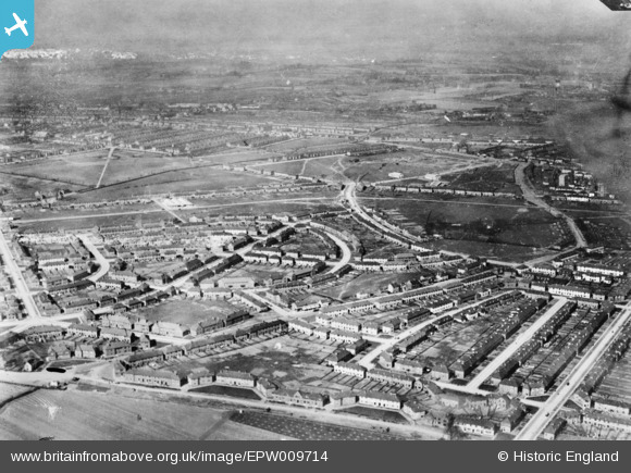
EPW009714 ENGLAND (1923). The Becontree Estate around Farmway, Becontree, from the south-east, 1923. This image has been produced from a copy-negative.
© Hawlfraint cyfranwyr OpenStreetMap a thrwyddedwyd gan yr OpenStreetMap Foundation. 2026. Trwyddedir y gartograffeg fel CC BY-SA.
Delweddau cyfagos (4)
EPW009714

EPW009713

EPW009716

EPW009715

Manylion
| Pennawd | [EPW009714] The Becontree Estate around Farmway, Becontree, from the south-east, 1923. This image has been produced from a copy-negative. |
| Cyfeirnod | EPW009714 |
| Dyddiad | 1923 |
| Dolen | |
| Enw lle | BECONTREE |
| Plwyf | |
| Ardal | |
| Gwlad | ENGLAND |
| Dwyreiniad / Gogleddiad | 547474, 185937 |
| Hydred / Lledred | 0.12735691500548, 51.552541677237 |
| Cyfeirnod Grid Cenedlaethol | TQ475859 |
Pinnau
Byddwch y cyntaf i ychwanegu sylw at y ddelwedd hon!