
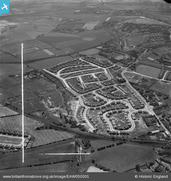
EAW050301 ENGLAND (1953). Council estate at Chickenley, Dewsbury, 1953. This image was marked by Aerofilms Ltd for photo editing.
© Hawlfraint cyfranwyr OpenStreetMap a thrwyddedwyd gan yr OpenStreetMap Foundation. 2026. Trwyddedir y gartograffeg fel CC BY-SA.
Delweddau cyfagos (7)
EAW050301

EAW050297

EAW050299

EAW050295

EAW050298

EAW050294

EAW050300

Manylion
| Pennawd | [EAW050301] Council estate at Chickenley, Dewsbury, 1953. This image was marked by Aerofilms Ltd for photo editing. |
| Cyfeirnod | EAW050301 |
| Dyddiad | 3-July-1953 |
| Dolen | |
| Enw lle | DEWSBURY |
| Plwyf | |
| Ardal | |
| Gwlad | ENGLAND |
| Dwyreiniad / Gogleddiad | 426640, 421204 |
| Hydred / Lledred | -1.5965758042394, 53.686382246319 |
| Cyfeirnod Grid Cenedlaethol | SE266212 |
Pinnau

Michael |
Tuesday 5th of November 2019 02:10:02 PM | |
|
Michael |
Monday 4th of November 2019 02:36:31 PM | |
|
Michael |
Monday 4th of November 2019 02:28:15 PM | |
|
Michael |
Monday 4th of November 2019 02:17:02 PM | |

JCollins |
Tuesday 13th of September 2016 10:30:16 AM |