
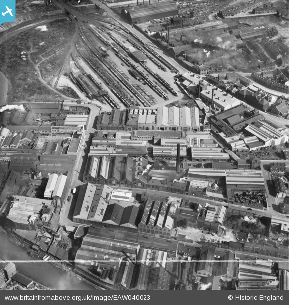
EAW040023 ENGLAND (1951). The Novo Steel Works and the surrounding industrial area, Attercliffe, 1951. This image was marked by Aerofilms Ltd for photo editing.
© Hawlfraint cyfranwyr OpenStreetMap a thrwyddedwyd gan yr OpenStreetMap Foundation. 2026. Trwyddedir y gartograffeg fel CC BY-SA.
Delweddau cyfagos (18)
EAW040023

EAW040020

EAW040025

EAW040024

EAW040021

EAW040018

EAW040019

EAW040022

EPW005953

EPW005955

EPW005950

EPW005951

EPW005954

EPW005956

EPW005952

EAW020079

EAW009656

EAW020078

Manylion
| Pennawd | [EAW040023] The Novo Steel Works and the surrounding industrial area, Attercliffe, 1951. This image was marked by Aerofilms Ltd for photo editing. |
| Cyfeirnod | EAW040023 |
| Dyddiad | 17-September-1951 |
| Dolen | |
| Enw lle | ATTERCLIFFE |
| Plwyf | |
| Ardal | |
| Gwlad | ENGLAND |
| Dwyreiniad / Gogleddiad | 437280, 388629 |
| Hydred / Lledred | -1.4393379699085, 53.392915586613 |
| Cyfeirnod Grid Cenedlaethol | SK373886 |
