
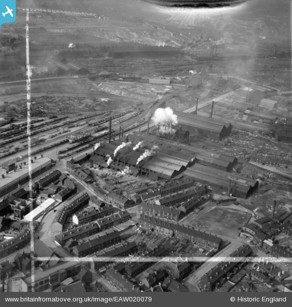
EAW020079 ENGLAND (1948). The English Steel Corporation Stevenson Road Works, Attercliffe, 1948. This image was marked by Aerofilms Ltd for photo editing.
© Hawlfraint cyfranwyr OpenStreetMap a thrwyddedwyd gan yr OpenStreetMap Foundation. 2026. Trwyddedir y gartograffeg fel CC BY-SA.
Delweddau cyfagos (21)
EAW020079

EAW018790

EAW020078

EAW018788

EAW020082

EAW018787

EAW020086

EAW018789

EAW018792

EAW020087

EAW020084

EAW018791

EAW020083

EAW040021

EAW040022

EAW020081

EAW020080

EAW020085

EAW040023

EAW040020

EAW040019

Manylion
| Pennawd | [EAW020079] The English Steel Corporation Stevenson Road Works, Attercliffe, 1948. This image was marked by Aerofilms Ltd for photo editing. |
| Cyfeirnod | EAW020079 |
| Dyddiad | 19-October-1948 |
| Dolen | |
| Enw lle | ATTERCLIFFE |
| Plwyf | |
| Ardal | |
| Gwlad | ENGLAND |
| Dwyreiniad / Gogleddiad | 437509, 388784 |
| Hydred / Lledred | -1.4358757477504, 53.394292690218 |
| Cyfeirnod Grid Cenedlaethol | SK375888 |
