
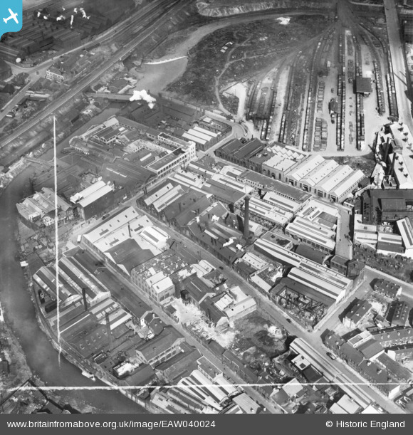
EAW040024 ENGLAND (1951). The Novo Steel Works and the surrounding industrial area, Attercliffe, 1951. This image was marked by Aerofilms Ltd for photo editing.
© Hawlfraint cyfranwyr OpenStreetMap a thrwyddedwyd gan yr OpenStreetMap Foundation. 2026. Trwyddedir y gartograffeg fel CC BY-SA.
Delweddau cyfagos (18)
EAW040024

EAW040025

EAW040023

EAW040018

EAW040020

EAW040019

EAW040021

EPW005955

EPW005953

EAW040022

EPW005950

EPW005956

EPW005954

EPW005951

EPW005952

EAW009656

EAW009657

EAW020078

Manylion
| Pennawd | [EAW040024] The Novo Steel Works and the surrounding industrial area, Attercliffe, 1951. This image was marked by Aerofilms Ltd for photo editing. |
| Cyfeirnod | EAW040024 |
| Dyddiad | 17-September-1951 |
| Dolen | |
| Enw lle | ATTERCLIFFE |
| Plwyf | |
| Ardal | |
| Gwlad | ENGLAND |
| Dwyreiniad / Gogleddiad | 437248, 388615 |
| Hydred / Lledred | -1.439820852069, 53.392791996582 |
| Cyfeirnod Grid Cenedlaethol | SK372886 |
Pinnau

Class31 |
Monday 27th of July 2015 10:54:53 AM | |
|
Class31 |
Monday 27th of July 2015 10:53:59 AM | |
|
Class31 |
Monday 27th of July 2015 10:53:40 AM | |

travellingpass |
Monday 29th of December 2014 10:48:01 AM |